2011
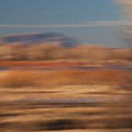
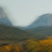
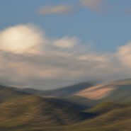
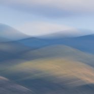
These six images complete my attempt to visually convey the 200 million year passage of time when Ghost Ranch’s oldest exposed rock became part of a collection of varicolored siltstone, mudstone and sandstone deposited by rivers.


2011
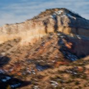
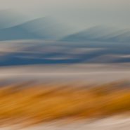
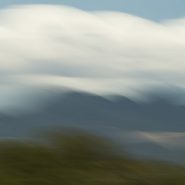
Just imagine that this landscape has been a relatively stable block of the earth’s crust for 600,000,000 years; and further that the oldest rocks exposed in the Ghost Ranch area are part of a thick collection of varicolored siltstone, mudstone and sandstone deposited by rivers more than 200,000,000 years ago, when this area was located less than 1/3 of the distance from the equator than it is today.
It is no wonder that I can’t resist overlaying this landscape with my own sense of the passage of time…


2011
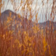
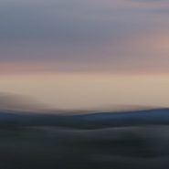
One hour north of Santa Fe is Georgia O’Keefe Country: vast vistas, table-topped mesas, tall cliffs, and winding rivers bordered by ancient cottonwoods.
Because this block of the earth’s crust remained relatively stable for 600 million years, the rocks around Ghost Ranch are generally flat-lying and less deformed by broad-scale folding. Situated within the broad shallow Chama Basin along the eastern margin of the Colorado Plateau’s transition to the Rio Grande Rift further east — and occupying parts of New Mexico, Arizona, Utah and Colorado — the oldest rocks exposed in the Ghost Ranch area are a thick collection of brick-red to red siltstone, mudstone, and white to tan sandstone, deposited by rivers more than 200 million years ago, when this area was located about 10 degrees north of the equator.
In 1929, Georgia O’Keefe first began painting part of each year in northern New Mexico. In 1934 she first visited Ghost Ranch; it’s varicolored cliffs inspired some of her most famous landscapes. In 1949, she made her permanent home on a cliff above Abiquiu. O’Keefe wrote in 1977: “Such a beautiful, untouched, lonely feeling place, such a fine part of what I call the “Faraway’. It is a place I have painted before… even now I must do it again”.
Nor have I been able to resist repeatedly overlaying this landscape with my own sense of the passage of time…


2013
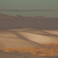
Most fascinating for me is the very different palette available shooting west as early light casts an orange glow on the gypsum sand, with various pan’s impact on the gypsum and the surrounding grasses.


2011
The White Sands National Monument, located 300 miles south of Santa Fe at the northern end of Mexico’s Chihuahuan Desert, is nestled in the high-desert Tularosa Basin (4,200′ el.). Between the San Andres Mountain Range, to the west, and the Sacramento Mountains to the east, are the astounding white-white wave-like gypsum dunes, that over millions of years have engulfed 275 square miles of desert, comprising the world’s largest gypsum dunefield.
Between enormous upheavals in the Earth’s crust 250 million years ago, followed by the uplift of these mountains 150 million years later, these huge gypsum deposits were exposed. Rainfall and snowmelt then leeched out the gypsum, washing it down the mountainsides, to accumulate in Lake Lucero, the lowest point in the basin. Without outfall drainage, evaporation left behind layers of crystallized gypsum that prevailing southwest winds have carried up the basin, piling them in dunes as high as 50 feet.
Sand dunes are always striking as their organic shapes and patterns constantly change the absorption and reflection of light, but snow-white dunes are even more unique. Unlike most quartz desert sands, glistening white sands are composed of gypsum and calcium sulphate; also, unlike most beaches, white sand is cool to the touch, due to the high rate of evaporation of surface moisture, since the sand reflects rather than absorbs the sun’s rays.
This first series of images were captured shooting west as last light approaches; while in my next blog are of images shooting east, capturing early light. Equally fascinating is how low-angled winter light casts diverse color on the bright white gypsum sand. Shadowed low and flat light creates a bluish cast when shooting west toward last light, while early light casts an orange glow on the gypsum sand.


2016
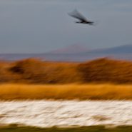
Images from these last four series represent my fourteen year (so far) quest to convey my impressions of the Bosque del Apache, as Sandhills course through dimly-lit high desert winter skies, to-and-from the wetlands, during a 3 to 4 month period each winter.


2016
At higher elevation, the brisk, late-light winter air barely illuminates the ever-so-quiet wetlands tapestry for the arrival of incoming migrating water fowl in the lee of the mountains to the west.
Ten to fifteen thousand mildly honking, considerably larger Sandhill Cranes follow in the wake of the tens of thousands of smaller but much more cacophonic snow geese…
And as the very last light descends, the wetlands regain their peacefulness — until the next morning’s very first light!


2012
During the coldest winter months, the Bosque del Apache’s diurnal rhythms are unbelievably consistent. At very first light the tremendous flocks of Snow Geese begin stirring, before rising in louder and larger groups that nearly blank out the sky, heading for adjoining grain fields to feed for the day; it’s only when no other creature can withstand the deafening din (transfering this bucolic scene into complete chaos), that the 12,000-to-15,000 Sandhills rise in smaller groups to also feed in the adjoining fields.
And then as the setting sun begins dropping behind the near western mountains, the enormous flocks of Snow Geese return, circling the wetlands before settling in for the night, followed more gradually by the larger, more majestic, and quieter Sandhills…


20XX
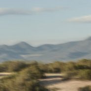
Following almost a month in Eastern Europe, I’m so glad to be back home in New Mexico’s high country, above 4,000′ elevation, which includes much of central and western New Mexico.
Always exhilarated by high-desert light, I’m starting off this year’s postings by re-visiting images of my favorite New Mexico locations, beginning with the Bosque del Apache National Wildlife Refuge, which is fed by the Río Grande, 150 miles south of Santa Fe. Established in 1939, this is a protected migratory stop for thousands of snow geese and upwards of 15,000 Sandhill Cranes heading south in November, then returning north beginning in February for breeding season.
Early winter light warms the soft wetlands screened by the 7,000′ Chupadera Mountains immediately to the west; as the sun clears the mountains, thousands of Snow Geese’s cacophony builds until the Sandhills too, with their six-foot wingspans, begin to lift off in twos and threes, heading for the nearby grain fields to feed for the day before returning, as the sun sets, to the wetlands’ 2-4′ of water.
So, this will be the first of the 4 Bosque del Apache favorites.


2003
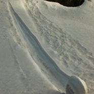
Early one winter morning 14 years ago, shortly after moving to Santa Fe, amidst its wonderful high desert landscape, I was driving up Santa Fe Mountain’s west face to continue my photographic study of its extensive Aspen stands. Upon rounding a sharp curve in the road — I happened upon an astounding and sublime surprise: a “snow spiral” which apparently had formed rolling down the steep slope. Not certain what I glimpsed, I stopped to take a closer look. And having never before seen anything like it, I just had to capture it!
Nor have I ever seen anything like it since…
Enjoy! Merry Christmas


2016
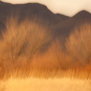
Further south in New Mexico’s high country — returning home to Santa Fe, where I have resided for the last 12 years — restraining my camera stroke enabled me to soften the the texture amongst the brighter colors…


2015
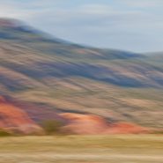
From 20 miles north of Santa Fe, my third and final series of the west face of the Sangre de Cristo mountain range. President Clinton was fond of saying, “its the economy stupid!”
Well, in photography, it’s all about the light…
On this day, the sun was “out full bore,” and because my captures were slightly earlier in the day, the sun still cleared the Jemiz Mountain range behind me; sunlight shined directly on Santa Fe Baldy, the highest peak in this section of the range. Blending the highlighted west face amongst its shadowed surroundings offered a very different series of compositions.


2015
Another series of captures from “my” 8,500′ ridge vantage point, 20 miles north of Santa Fe, offers dramatic “takes” of the Sangre’s west face — including its foothills — leading up to its 12,000′ peaks perched under a late afternoon sky.
As direct sunlight still bathes the nearby foothills, the receding Sangre peaks read as a distant blue line of demarcation that separate the Blood of Christ ridge from the Western cloud-laden sky. These three receding horizontal elements of color and texture afford an array of blending possibilities…


2015
Returning to one of my favorite New Mexico palettes — just twenty miles north of my home in Santa Fe — an accessible 8,500 foot ridge offers unobstructed views across the 2-3 mile wide valley directly into the entire west face of the Blood of Christ mountain range, from its foothills all the way up and beyond its 12,000′ peaks, which are so often crowned with a continuously-modulating cloud cap as the evening light descends.
An always-varying palette of color, shadow, texture and form…


2014
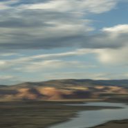
Abiquiu Lake is a reservoir located in Rio Arriba County 60 miles north of Santa Fe.
The Rio Chama was damned in 1963 to create the 5,200 acre Abiquiu Lake, which is more than 12 miles long at an elevation of 6,100 feet.
From the bluffs along the southern side of the lake, the views north of the red cliffs that frame Ghost Ranch are just beautiful. Behind (south of) the lake is the very distinctive 9,862′ mountain, Cerro Pedernal.


2014
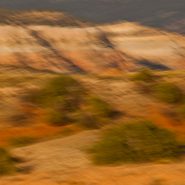
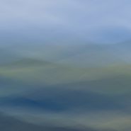
This is the third and final series of the Ortiz Mountains. In each of these images, I have stroked the camera ‘with the grain,’ while simultaneously also stroking ‘cross-grain;’ the resultant complex-curve pans, enable me to add depth and volume to these images which I like to think of as my own single-frame ‘Virtual Realities.’


2014
Continuing my visual exploration of the Ortiz Mountains, I have augmented each of these images with a stretched sense of the passage of time — in order to emphasize and meld the 30 million years consumed in their creation. Panning my camera of this small mountain range at shutter speeds of less than 1/15 second, takes me a step toward my own pursuit of Virtual Reality!


2014
A while back, I had the opportunity to ‘house-sit’ for friends who live on a ridge overlooking the Ortiz Mountains in the southern quadrant of Galisteo Basin, twenty miles south of my home in Santa Fe. Three weeks of this particular view gave me the opportunity to pursue different visual themes of the Ortiz: more or less straightforward photographic capture, plus overlaying the scene with varying motion strokes to stretch, and cross-cut the scene; and then to incorporate dramatic first and last New Mexico light to once again re-integrate my strokes.


2013
The initial challenge for me was to compose vertical slices of landscape within the camera vs. carving a vertical image out of an existing horizontal image. Either way though, it causes me to see differently, which is my objective. Limiting much of the surroundings enables me to emphasize verticality.
These eight totems, drawing from both approaches, are meant to provide a different perspective on one of New Mexico’s truly beautiful locations.


