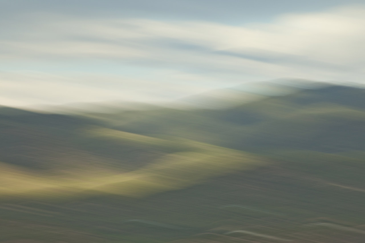
2013
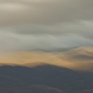
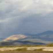
The 9th of ten successive explorations of the Santa Fe Baldy portion of the Sangre de Cristo range, immediately north of Santa Fe.
Winter’s earlier, crisper light emphasizes Santa Fe Baldy’s west face, especially when framed with low hanging clouds.


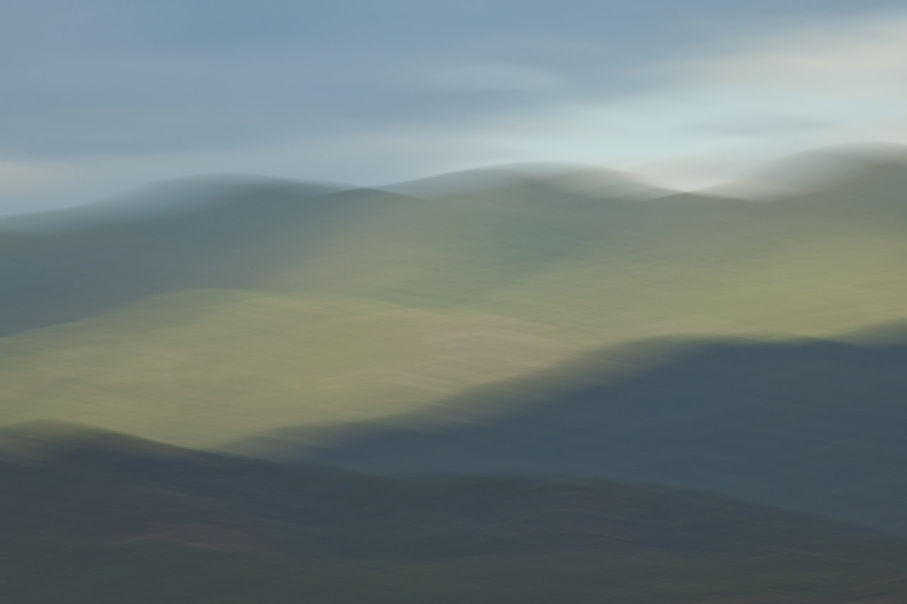
2013
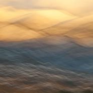
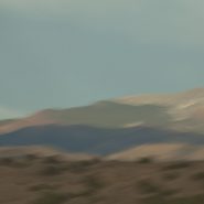
As winter sets in I continue my visual explorations of the Sangre de Cristo mountain ridge surrounding New Mexico’s 4th highest peak, Santa Fe Baldy.
Blending the snow-covered mountains’ more subtle palette allows for a very different interpretation…


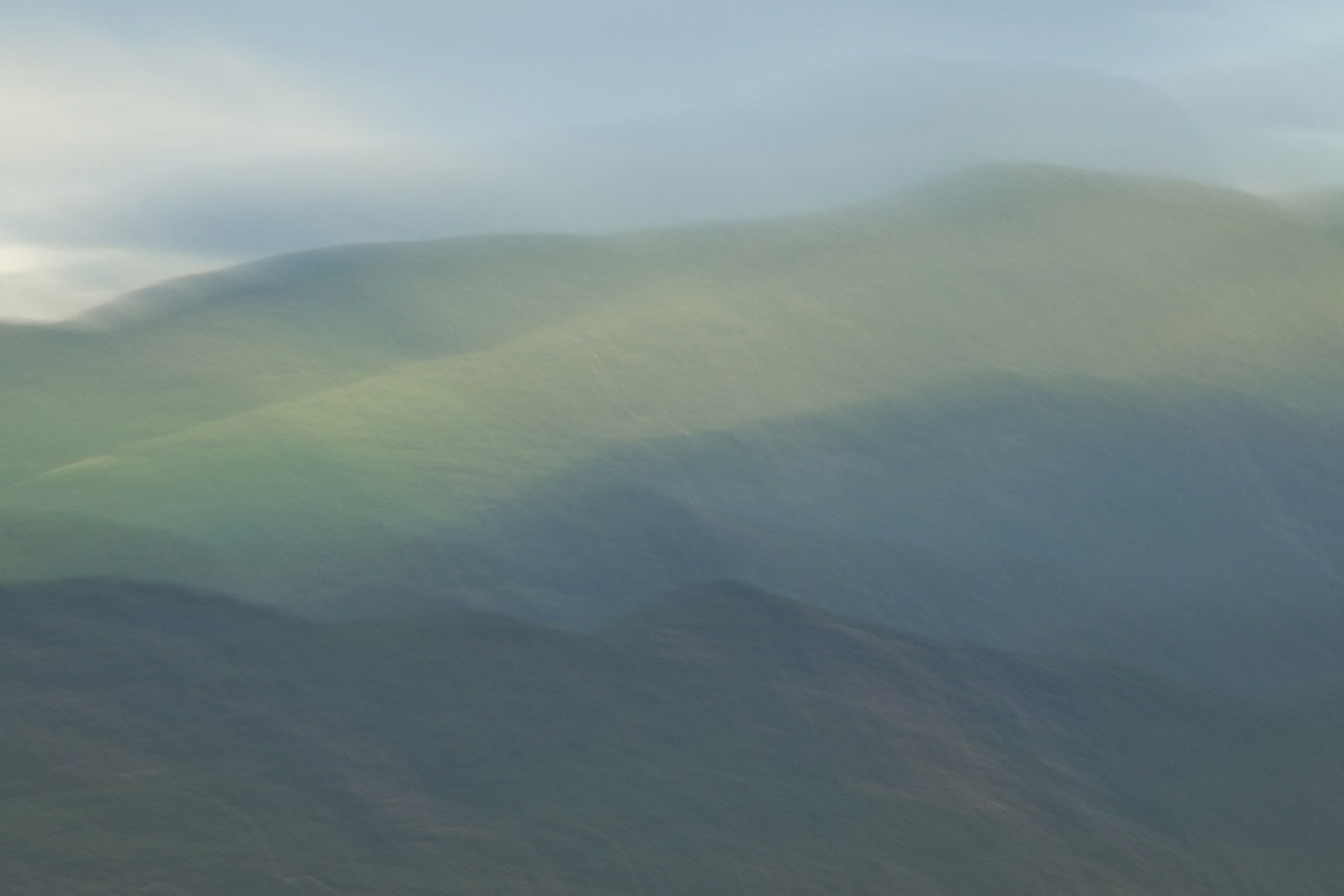
2013
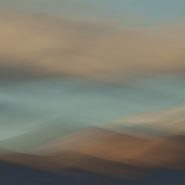
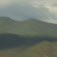
Continuing my visual explorations just north of Santa Fe, as the weather turns, the contrast of light, clouds and first snow intensifies against the 12,000′ Sangre de Cristo mountain ridge that surrounds New Mexico’s 4th highest peak, Santa Fe Baldy.
In turn, this further reduction of my blended elements to three emphasizes how I see and interpret this landscape.


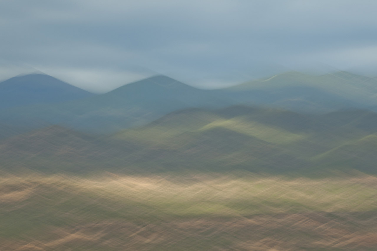
2013
I’m now half-way through introducing the results of my visual exploration of the 12,000′ Sangre de Cristo mountain ridge clustered around Santa Fe Baldy, New Mexico’s 4th highest peak, just north of Santa Fe.
Reducing the variables in each image – shooting from the same location, and at nearly the same time – reveals not only what I am seeing, but how I am seeing. Blending my motion-strokes against the mountain tops emphasizes the light’s particular hue, and how that hue casts upon Santa Fe Baldy.
2013
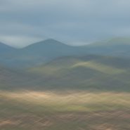
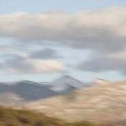
The fourth of ten successive explorations of the Santa Fe Baldy portion of the Sangre de Cristo range, just north of Santa Fe.


2013
Santa Fe, New Mexico’s capitol, lies along the western edge of the Sangre de Cristo (Spanish for Blood of Christ) Mountain Range, which is the most southern subrange of the Rocky Mountains. Twenty miles west of Santa Fe is the Jemez Mountain Range, with the Río Grande flowing south between the two…
Less than 20 miles north of Santa Fe is a stretch of the Sangres that includes the third and fourth highest mountains in New Mexico: Truchas Peak (13,108′) and Santa Fe Baldy (12,632′). With this section of the Sangres so close to Santa Fe and so visually accessible, I decided to do an extended study of the setting sun’s effect on these peaks during the spring and summer of 2013. My light exploration was optimally accessed by a ridge five miles west, which placed me at the upper edge of the foothills.
This vantage point allowed me to concentrate on the elements of this mountainous landscape — light, shadow, and form — while enabling me to blend these elements with the foothills, the peaks, and the sky in various combinations.
Each of the successive permutations also reflects a single capture spanning no more than an hour of New Mexico’s last light.


2012
The Sangre de Cristo (Blood of Christ) Mountain range is the southernmost subrange of the Rockies; they begin in Southern Colorado and extend south to just below Santa Fe. At the north end of town, on the Sangre’s western slope is Santa Fe Mountain, whose west face is covered with very large Aspen stands.
Native to cold regions with cool summers at altitudes above 5,000 feet, aspens are medium-sized deciduous trees reaching as high as 100′. They generally grow in large colonies derived from a single seedling and spread by means of root suckers whose new stems may appear more than 100 feet from the parent tree. While each individual tree can live for 40 to 150 years, they send up new trunks as the older trunks die off above ground, so their root systems are long-lived, in some cases for thousands of years, which is why aspen stands are considered to be ancient woodlands.
Come the end of September through mid-October, the west face of Santa Fe Mountain lights up as the Aspen leaves turn their beautiful, riotous, yellow. Illuminated by the lower angle of fall sunsets, the light is just magical.


Read More
2011
The Truchas Peaks are 25 miles northeast of Santa Fe in the Sangre de Cristo Mountains. Spanish for “trout”, it is north-south trending with four identifiable summits including South Truchas Peak, 13,102’, the second highest independent peak in New Mexico and North Truchas Peak, 13,024’.
The birth of the Sangre de Cristos Mountains, the southernmost subrange of the Rockies, began 80 million years ago when the Farallon Plate slid under the North American Plate at such a shallow subduction, it created a broad belt of mountains running down North America. The low angle moved the focus of crustal melting and mountain building much farther inland than the normal 2-300 miles. Over the past 60 million years, erosion stripped away the high rocks, revealing the ancestral rocks beneath, which have since been eroded by water and glaciers to sculpt the Rockies into dramatic peaks and valleys.
I was fortunate to capture Truchas Peaks in late light, immediately following the first snow.


Read More
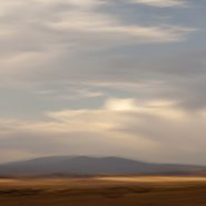
2011
So taken by this basin’s spectacular views at Santa Fe’s southern doorstep, I find myself returning again and again.
An upwelling of the Earth’s mantle thirty million years ago caused a pair of parallel fault zones, 40 miles apart, to cut north-south through New Mexico from the San Juan Mountains in south central Colorado to the southwestern tip of Texas; 8-10 million years later, this slice of the Earth’s crust sank as much as 5 miles, creating the Rio Grande Rift, which in turn extended a network of fault patterns that pulled apart the Earth’s crust to the breaking point. From the Rio Grande Rift west to the Sierras, these faults were the genesis of the southwest’s predominate Basin & Range topography: fallen crustal blocks created basins; uplifted blocks became mountain ranges.
Low-angled high-desert light with some cloud cover makes it possible to emphasize the differing characters of these surrounding mountains
To view more images of Galisteo Basin, see Galisteo Basin I and Galisteo Basin III


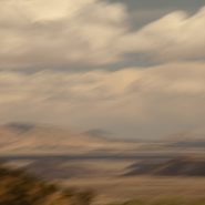
2011
The Galisteo Basin is classic northern New Mexico high desert landscape. Surrounded by very visible mountain ranges this basin is situated on the east side of the Rio Grande between Santa Fe and Albuquerque. Tilted, and interspersed with wide-open plateaus, the basin offers dramatic views in all directions.
This particular series is the result of one afternoon’s roadtrip south from Galisteo to Stanley, along the east side of the Ortiz, Captain Davis and Lone Mountains, and further south, east of the Sandia Mountains.
Like so much of the American west, what is visible today was formed over the last 30 million years, amounting to less than 1% of the Earth’s 4.6 billion year age
To view more images of Galisteo Basin, see Galisteo Basin II and Galisteo Basin III


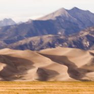
2007
As the sun drops behind the San Juan Mountains, 75 miles across the San Luis Valley, the last direct light on North America‘s tallest and highest dunes causes the volcanic sand to glow.
This Colorado dune field evolved out of the last major volcanic activity in the San Juan Mountains, 30 million years ago. The Rio Grande carried volcanic ash eastward, while prevailing southwesterly winds plus the snowmelt from the Sangre de Cristo Mountains have maintained its unique balance.
My own visual interpretation of the events that have created this particular evolution in the passage of time is not unlike The Jicarilla Apaches’ “it goes up and down” and the Utes’ “the land that moves back and forth.”


