2014
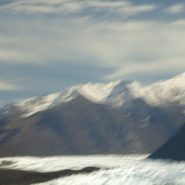
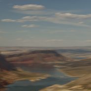
Abiquiu Lake is a reservoir located in Rio Arriba County 60 miles north of Santa Fe.
The Rio Chama was damned in 1963 to create the 5,200 acre Abiquiu Lake, which is more than 12 miles long at an elevation of 6,100 feet.
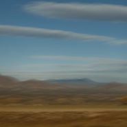
From the bluffs along the southern side of the lake, the views north of the red cliffs that frame Ghost Ranch are just beautiful. Behind (south of) the lake is the very distinctive 9,862′ mountain, Cerro Pedernal.


2014
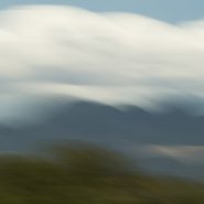
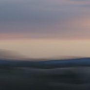
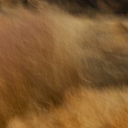
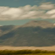
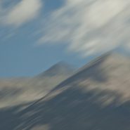
This is the third and final series of the Ortiz Mountains. In each of these images, I have stroked the camera ‘with the grain,’ while simultaneously also stroking ‘cross-grain;’ the resultant complex-curve pans, enable me to add depth and volume to these images which I like to think of as my own single-frame ‘Virtual Realities.’


2014
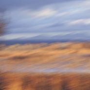
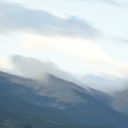
Continuing my visual exploration of the Ortiz Mountains, I have augmented each of these images with a stretched sense of the passage of time — in order to emphasize and meld the 30 million years consumed in their creation. Panning my camera of this small mountain range at shutter speeds of less than 1/15 second, takes me a step toward my own pursuit of Virtual Reality!


2014
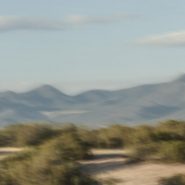
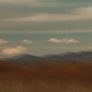
A while back, I had the opportunity to ‘house-sit’ for friends who live on a ridge overlooking the Ortiz Mountains in the southern quadrant of Galisteo Basin, twenty miles south of my home in Santa Fe. Three weeks of this particular view gave me the opportunity to pursue different visual themes of the Ortiz: more or less straightforward photographic capture, plus overlaying the scene with varying motion strokes to stretch, and cross-cut the scene; and then to incorporate dramatic first and last New Mexico light to once again re-integrate my strokes.


2013
The initial challenge for me was to compose vertical slices of landscape within the camera vs. carving a vertical image out of an existing horizontal image. Either way though, it causes me to see differently, which is my objective. Limiting much of the surroundings enables me to emphasize verticality.
These eight totems, drawing from both approaches, are meant to provide a different perspective on one of New Mexico’s truly beautiful locations.


2013
As the last light falls on the bosque’s marsh grasses, the range of red-browns gradually fades against the Chupadera Mountains, leaving hardly any visible contrast with the tens of thousands of snow geese and sandhills that have now settled in, quieting with only occasional chatter.
Nearby grasses bordering a canal contrast ever more softly against the flowing water in the marshes. And then it becomes so quiet, no one would believe that only a few hundred yards away a vast carpet of migratory fowl await daybreak’s signal to once again awake, rise and fly out to the fields to feed.


Read More
2013
As the sun begins to set, the daily ‘fly-in’ commences with the gradual return of all the snow geese and sandhills to the relative safety of the bosque’s 3-to-4 feet of water. Announcing their arrival with incessant honking as they circle and set down, the very low-angled light of sunset provides a dramatic backdrop.


2013
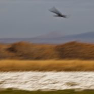
Tens of thousands of snow geese and as many as 15,000 sandhill cranes begin arriving mid-November to rest and refuel from their long southern migration flights. Most will stay until the end of January, spending each night safe from predators in 2-to-3 feet of marsh water. At dawn, the snow geese begin stirring; soon their honking and flapping of wings raises to such a din, flock after flock lift off, ‛flying out’ to the surrounding fields to feed. As the sun sets, they return to the wetlands for the night.
This time of year thousands of people are drawn to Bosque Apache to witness this twice daily incredible ‛sight, sound, and motion’ show, which is further enhanced by the low-angled winter sun as the birds circle against the 7,000′ Chupadera Mountains.


2013
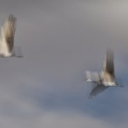
Each morning during their migration rest at Bosque del Apache, the Sandhill Cranes rise from fields flooded by 2-3 feet of water, where they are safe from predators. In groups of 3 to 10 they fly to nearby grain fields, where they spend the day feeding, only to rise again as the day fades and return to the safety of the wetlands for the night.
Weighing 8 to 10 lbs. and with a wingspan of up to 6 feet, Sandhills look ungainly while standing, but stretch into beautiful aerodynamic form with their powerful pumping wings slowly lifting them into the sky


2013
Twelve years ago I moved from Maryland’s very flat, eastern shore to Santa Fe to live amongst beautiful mountains bathed by incredible high desert light. Yet I still can’t quite believe the anomaly that is the 4,500′ Bosque del Apache wetlands preserve.
The wetlands’ color and texture magically blend against the Chupadera mountains’ 7,000′ east face during the sun’s morning ascent.


2013
As the sun begins its climb, the wetlands gradually emerge from darkness, revealing wonderfully subtle shades against the water, whether still or rippling. Continuing to climb, the light’s angle widens against increasing color variations and emerging shadows until thousands of light geese stir with their gutteral cries, as the wetland colors and textures explode…


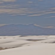
2013
At 4,000′ elevation, the 275 square mile White Sands’ dune field comprises the world’s largest surface deposit of gypsum. Located 250 miles south of Albuquerque, and just north of the White Sands Missle Test Center, White Sands National Monument is situated in New Mexico’s Tularosa Basin between two 8-9,000′ North-South mountain ranges — the San Andreas Mountains to the west, and the Sacramento Mountains to the east.
The white gypsum sand is unlike typical desert sands made of quartz, or sand found on most beaches. Because the white gypsum reflects the sun’s rays resulting in a high rate of evaporation of surface moisture, the white gypsum sand is cool to the touch.
Because of southern New Mexico’s exceptionally clear weather, Germany trains their fighter pilots from an airbase 20 miles SE of White Sands; often they leave contrails that contrast dramatically against New Mexico’s blue, blue skies.


2013
15 miles north of Blanca Peak, a Colorado sand dune field emerged as a result of the last major volcanic activity in the San Juan Mountains some 30 million years ago. As the Rio Grande carried volcanic ash eastward, prevailing southwesterly winds – offset by the Sangre de Cristo Mountains’ snowmelt – maintained the unique balance of these trapped dunes: shifting back and forth according to the strength and direction of the prevailing wind relative to the degree of the snowmelt’s runoff.
Reaching heights of 750′, these are the highest and tallest sand dunes in North America.
Native Americans have long observed this unique dune field’s wandering, shifting nature: the Jicarilla Apaches: “it goes up and down,” and the Utes: “the land that moves back and forth.”


2013
Twenty miles northeast of Alamosa, at the very southern end of the more extensive Sangre de Cristo range, Blanca Peak, at 14,351′, is the highest summit of the Sierra Blanca Massif, the Sangre de Cristo Mountains, as well as the highest point within the Rio Grande’s entire drainage basin. In addition to being the fourth highest peak in Colorado, Blanca Peak is higher than any point east in the U.S.
Known to the Navajo nation as the Sacred Mountain of the East, Blanca Peak is considered to be the eastern boundary of the Dinetah, the traditional Navajo homeland.


2013
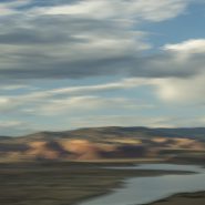
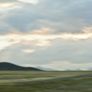
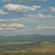
San Luis Valley — 8,000 sq. miles, averaging 7,600′ elevation — is the largest high desert valley in North America. Situated in south central Colorado, with a small portion extending south into central New Mexico, this gradually-sloping, 122 mile long north-to-south flat basin, 74 miles wide, separates Colorado’s two largest mountain ranges – the San Juans to the west, and the Sangre de Cristos to the east.
As part of the Rio Grande Rift, San Luis Valley extends east from the Continental Divide. The Rio Grande River rises out of the eastern San Juan Mountains and flows south into New Mexico; Colorado rivers west of the Continental Divide are drained by the Colorado River. Receiving little precipitation, the San Luis Valley is comprised of desert lands; with no clear southern boundary, it is generally considered to include the San Luis Hills of southern Colorado and the Taos Plateau of northern New Mexico.
Along the eastern edge of San Luis Valley are two significant features:
Blanca Peak, at 14,351′, is the fourth highest mountain in Colorado, and the highest peak in the Sangre de Cristo Mountains. Situated at the southern end of the more extensive Sangre de Cristo Range, it is the highest peak in both ranges, and is located 20 miles east-northeast of the town of Alamosa. Blanca Peak is also the highest point of the entire drainage basin of the Rio Grande, and is higher than any point in the U.S. east of its longitude.
Fifteen miles northwest of Blanca Peak, the Great Sand Dunes National Park and Preserve is situated in the lee of the Sangre de Cristos. These sand dunes, reaching as high as 750′, are the highest in North America.


2013
At 12,095′ elevation, this narrow strip of the Continental Divide is the high and extensive Sawatch Range of the Rocky Mountains of central Colorado. Situated midway between Aspen and Twin Lakes, it includes eight of the twenty highest Rocky Mountain peaks. Independence Pass is the highest paved crossing of the Continental Divide in the US.
Overlooking the alpine tundra environment above the treeline, Independence Pass offers incredible views east of Mt. Elbert, Colorado’s highest peak, and the second highest mountain in the contiguous United States.


2013
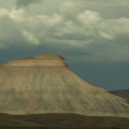
Mount Garfield at 6,780′ elevation is the high point of the Book Cliffs range — a series of desert mountains and cliffs stretching 200 miles from western Colorado into eastern Utah, north of Grand Junction. Appearing primarily along the southern and western edge of the Tavaputs Plateau, these cliffs are largely composed of sedimentary materials that cap many of the south-facing buttes, appearing similar to a shelf of books.
Within the Colorado Plateau geologic province, these cliffs of Cretaceous sandstone begin where the Colorado River descends south through De Beque Canyon into the Grand Valley before running west to Price Canyon near Helper, UT.


2013
The Green River is both the inflow and outflow of Flaming Gorge Reservoir, whose elevation when full is 6,040′. Created in 1964 by the completion of the Flaming Gorge Dam, the reservoir is mostly situated in Wyoming, as its northern tip is only 14 miles southwest of Rock Springs, WY. Just its southern end dips into northeastern Utah.
Rising out of western Wyoming’s Wind River Mountains, the Green River is the principal tributary of the Colorado River. During John Wesley Powell’s 1869 expedition down the Green River, he named the Flaming Gorge for its spectacular red sandstone cliffs surrounding this part of the river. The Green River continues south through Utah, before it merges with the Colorado River 40 miles into western Colorado.


Read More
2013
Another Rocky Mountain range in Western Wyoming, The Winds run generally NW-SE for about 100 miles, and include more than 40 peaks in excess of 13,000′. Gannett Peak, at 13,809′ is the highest mountain in Wyoming, though only 33′ higher than the 13,776′ Grand Teton. Except for Grand Teton, the next 19 highest peaks in Wyoming, are in The Winds. Two National Forests and three wilderness areas encompass most of the Wind River Range, as the Continental Divide follows its crest.
Shoshone National Forest on its east side, and Bridger-Teton National Forest to the west, and the entire Wind River range, are all part of the Greater Yellowstone Ecosystem. Portions of the range are also within the Wind River Indian Reservation.
Indigenous peoples of the Great Basin, such as the Shoshones and Absarokas (Crow) Native Americans lived in the range beginning 7,000 and 9,000 years ago.


