2014
Antarctica – the most extreme place on Earth!
Colder and windier than anywhere else on our planet, nothing has melted there in 40 million years; drier than anywhere else on Earth, though covered with 90% of Earth’s fresh water (as ice); the fifth largest continent on Earth has the highest average elevation as it is covered with 5,000 feet of ice.
Situated at the bottom of the Earth, beginning 500 miles south of the southern tip of South America, it spans the South Pole, where it is completely surrounded on all sides by some of Earth’s most treacherous oceans.
The only warm-blooded creatures that can live there year-round, are penguins, plus a few scientists.
As global warming continues, glaciers larger than small countries along both it’s southwestern and eastern edges, have now begun calving. not if, but when just half of this calving ice melts completely over the next 50 years, Earth’s sea level will rise more than 25 feet!
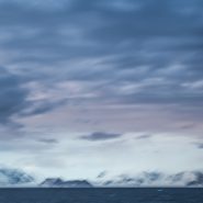
Uninhabitable as the Antarctic continent is, it is so very beautiful: white ice and snow covers the entire continent (except where the rock is so vertical that ice can not cling to it) against its backdrop of roiling oceans filled with thousands of smaller chunks of ice. When the weather is clear, the light is piercingly bright, casting long shadows against the surrounding ocean.


2014
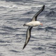
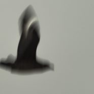
The fossil records of both Albatrosses and Petrels go back nearly 60M years; both are pelagic, since they only return to land to breed. Dominant in the Southern Oceans, albatrosses and giant petrels are convergent, so while not closely related, they have independently evolved similar traits as a result of having to adapt to similar environments.
Albatrosses comprise a group of 22 species of large to very large birds, and are among the largest flying birds. Both albatrosses and petrels are tube-nosed seabirds with strong and sharp-edged bills, with their upper mandible terminating in a large hook. Along each side of their bill are tubes (long nostrils) that enable albatrosses and petrels to measure their exact airspeed during flight – analogous to the pilot tubes in modern aircraft – and thus are highly efficient in the air. With their ability to use dynamic soaring and slope soaring, they are able to cover great distances with minimal exertion.
In addition to wingspans of at least 8-10 feet, albatrosses’ wings are stiff and cambered, with thickened streamlined leading edges. They travel huge distances using two techniques common to any long-winged seabird: dynamic soaring and slope soaring. Dynamic soaring involves repeatedly rising into the wind and descending downwind, thus gaining energy from the vertical wind gradient, with effort only expended in turns at the top and bottom of each loop. This maneuver enables them to cover about 600 miles a day without flapping their wings. Slope soaring uses the rising air on the windward side of large waves. Albatrosses’ very high glide ratios of 22:1 means that they can travel forward a distance 22 times the drop. Further, they are aided in soaring by a shoulder-lock, a sheet of tendon that locks the wing when fully extended, allowing the wing to be outstretched without any muscle expenditure, a morphological adaptation they share with the giant petrels.
All albatrosses are listed to be at some level of endangerment as a result of the serious decline in fish stock, from overfishing, and from being hooked by longline fishing gear. Both feed on squid, fish and krill, by either scavenging, surface seizing, or diving. And their breeding season can take over a year from laying to fledging with a single egg laid in each breeding attempt.
Combining their soaring techniques with their use of predictable weather systems, Albatrosses in the Southern Hemisphere flying north will take a clockwise route, while those flying south will fly counterclockwise. So well adapted to this lifestyle, their heart rates while flying are close to the basal heart rate when resting. Their flying intensity is such that the most energetically demanding aspect of a foraging trip is not the distance covered, but the landings, take-offs and hunting undertaken to find a food source.
Albatrosses live much longer than other birds; they delay breeding far longer and invest more effort into fewer young. Most species survive upwards of 50 years.
Capturing Albatrosses and Petrels in flight by camera, from a moving, bouncing ship in high seas is an exciting and exhausting challenge. With their habit of closely following ships for what might possibly be discharged, plus their natural tendency to glide within the ship’s draft, they definitely try to see just how close they can fly to the ship before having to veer off…


2014
Fur Seals and Whales are widely distributed in the Southern Ocean within the Antarctic Convergence – the zone of water between the frigid waters of the true Antarctic and more temperate waters to the north. Most of the Fur Seal population breeds on South Georgia Island, and other nearby sub-Antarctic islands.
Fur Seals average 6-7 feet in length and weigh 200-250 pounds, and up to 400 lb. for the males. Their diet includes krill, squid and fish. The males tend to live about 15 years, while females live to 25 years on average. Antarctic Fur Seals are an example of seals that can walk on land, because of their ability to turn their rear flippers forward, converting them into useful “feet”.
Generally Fur Seals are a solo act outside of mating season although they will congregate in vast numbers on beaches near good feeding grounds in the autumn and early winter, often near penguin colonies. Breeding season begins in late October through December. Males fight extremely aggressively, with some encounters resulting in death, for the right to rule harems of up to 20 females (who wouldn’t?). Once they’ve established a harem, males are unwilling to leave them unprotected and will stay on land for up to 2 months without feeding. When the females arrive they are already pregnant from the previous year’s season, and give birth in November and December. The females mate about a week after giving birth. The pups are nursed by their mothers for about 4 months. Once they have learned to swim they usually stay at sea a number of years until they reach sexual maturity, at which point they return to land to join the others during the mating season.
Fur Seals’ natural predators are Sharks and Killer Whales, while the pups are vulnerable to Leopard Seals.
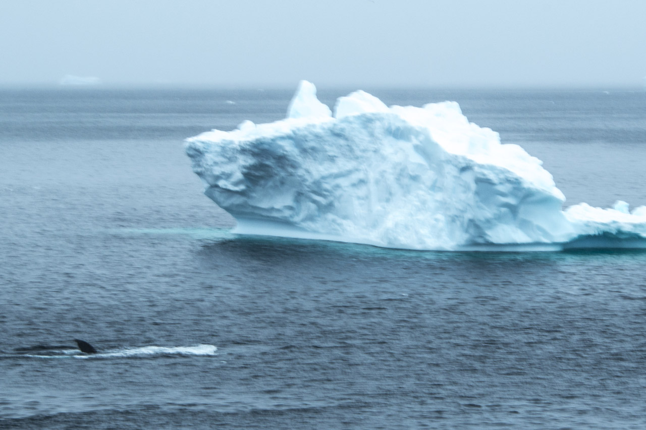
Whales most commonly found in the Southern Ocean are Humpback, Fin, with lesser numbers of Blue Whales. They are after the tremendous schools of high-protein krill.
Though I didn’t get to witness this, Orcas are known to hunt in packs, seeking out Fur Seals on small icebergs. Surrounding the iceberg, they repeatedly swim under it in unison, until the iceberg either tips, or breaks up as a result of the vibration created by the Orcas, at which point they grab the Fur Seal.
Fur Seals, when on shore, are readily visible; they often hang out near penguin colonies. Whales, on the other hand, are generally visible only at greater distances, or occasionally when they happen to surface very close.


2014
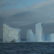
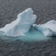
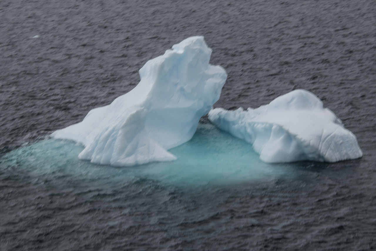
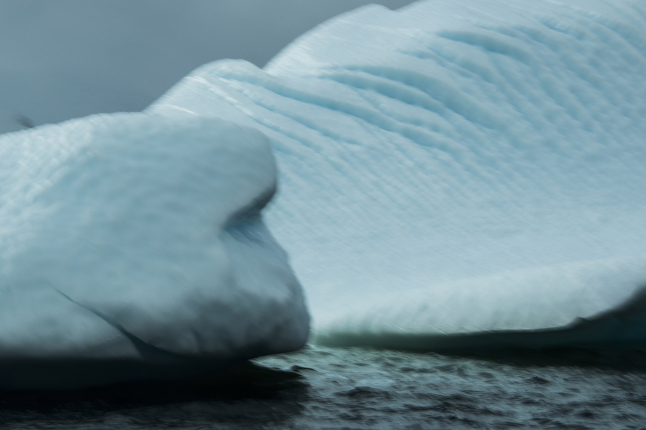
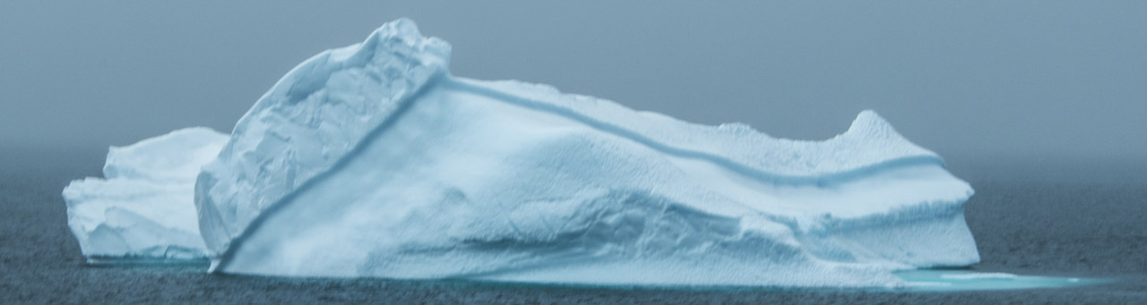
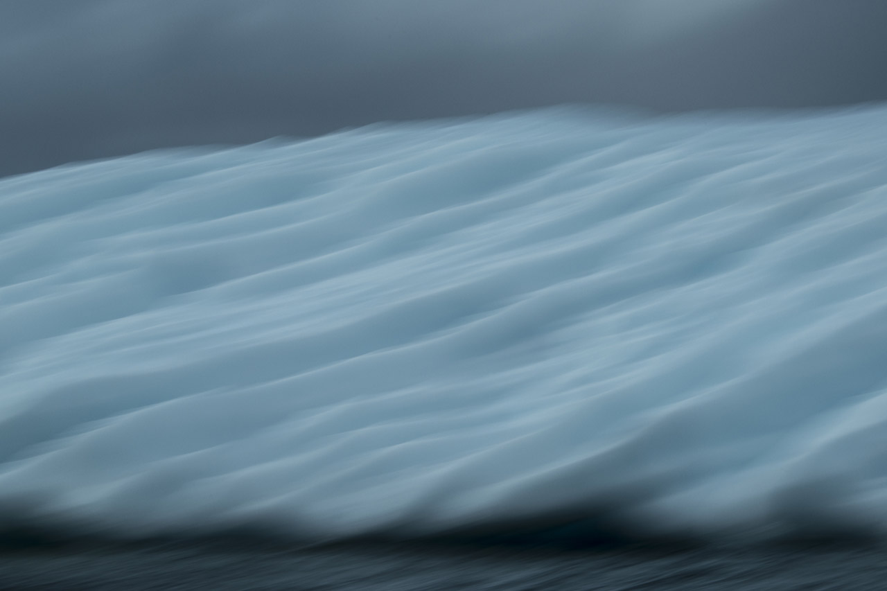
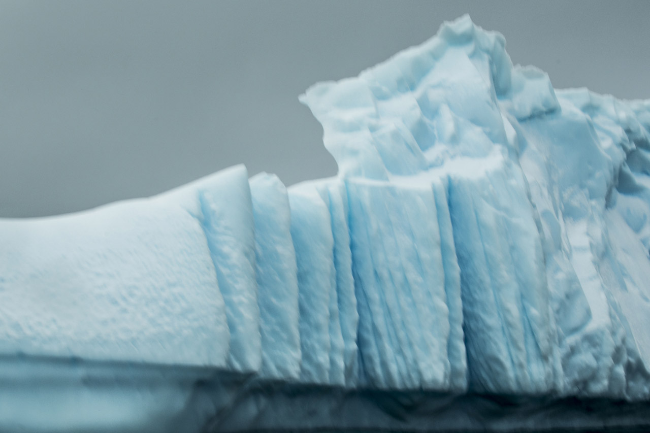
As snow continually falls, but rarely melts in Antarctica, the weight of its ice sheets constantly increases, while the weight of the air bubbles in the ice are squeezed out and the ice crystals enlarge, making the ice appear blue. Along the coasts, the glaciers/ice shelves slowly crack off, calving as icebergs; due to their displacement, about 90% of all icebergs are actually below the ocean’s surface.
Small amounts of new ice appear to be white because they contain plenty of air bubbles, while small quantities of water appear to be colorless. But as ice continues to form, the pressure of the added weight squeezes out the air bubbles, increasing the ice’s density. And just as large quantities of water appear to be blue, since they absorb other colors more efficiently than blue, a large piece of compressed ice – a glacier – can also appear blue.
Until recently the Antarctic Ice Sheet had been considered to be fairly stable in how it retreated. A recent study by Peter Clark, a climate scientist at Oregon State University, concludes however, that “New evidence shows that the ice sheet is much more dynamic and episodic, and contributes to rapid sea-level rise.” Published in the journal Nature, his study includes measurements at Antarctica’s largest glaciers – Thwaites and Pine Island – proving that during a warming trend which occurred 14,600 years ago – these ice sheets launched enough icebergs into the ocean that the sea level rose 6.5 feet in just 100 years. This evidence of dramatic melting in Antarctica’s past supports predictions for its future: that so many of Antarctica’s melting glaciers are now on the brink of a similar massive retreat.
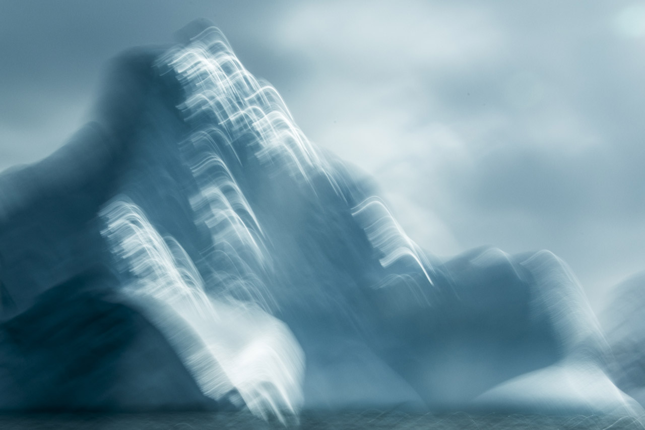
Icebergs are fascinating, as they can be as big as mountains, or islands, or as small as very small chunks of ice, of any shape, and having any texture; and they can range from very blue to quite white, depending on the sunlight or lack of it; and the nearly 90% that is underwater can either be somewhat visible, or not visible at all.
So often in nature, when concentrating on one scene or object – such as a mountain, or a cloud, or an iceberg, it is fascinating how often one can see in one’s own mind – recognizable shapes – pareidolias – if you will: Dancing, Passing by, Two Critters, Penguin in Repose…

2014
Penguins vs. Skuas
Of the 17 penguin species, Adelies, Chinstraps and Gentoos, averaging 30″ in height (males weigh from 10 to 18 lb., and females slightly less) are the most prominent on the Antarctic peninsula and surrounding islands, where they spend about half their time on land and half in the ocean.
Further south, at the South Pole, where it is much colder, the Emperor Penguin reaches 5′ in height.
Antarctic penguins form breeding colonies ranging from thirty to thousands of pairs, and establish their nesting grounds between June and November. Each of the Antarctic penguins species create their own separate breeding colonies, where each penguin pair construct a nest from stones, grass and moss, in which are laid two white, spherical eggs that are incubated by both male and female for 30 to 40 days. Penguin chicks fledge 2 to 3 months later, but continue to be fed by their parents for 2 to 6 months.
The Gentoo are readily distinguished by their orange-red bill and conspicuous white patches above each eye. They have pale whitish-pink webbed feet and fairly long tails, which is the most prominent tail of all penguins. The gentoo penguin trumpets loudly with its head thrown back.
Antarctic penguins reach sexual maturity at the age of two years, typically return to their previous year’s nest, and are loyal to breeding partners, with many forming long-lasting pair bonds.
Walking with their rather comedic, waddling gate on land, with flippers extended for balance; on downward slopes penguins readily flop over and slide on their bellies. In the water where their streamlined body and flippers provide propulsion up to 20 miles per hour, penguins reach depths of 200 meters in pursuit of their diet of Atlantic krill, squid, and fish.
Breeding on sub-Antarctic islands and the Antarctic peninsula, their non-breeding range is not fully known, but they have been found as far north as New Zealand, Australia and Argentina.
Penguins are the only warm-blooded creature able to tolerate Antarctica winters, which is one of the coldest environments on Earth. A thick layer of fat under their skin, covered by feathers that help to insulate them, provides a waterproof layer for extra protection.
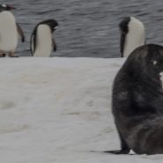
Without any land-based predators, penguins are not afraid or even distressed by humans. Their biggest threat is the Leopard Seal — one of the sourthern-most species of seal and a dominant predator in the Southern Ocean.
Penguins’ single most feared foe, however, is the Skua, a large brownish, highly predatory seabird related to gulls that feed on other birds, penguin eggs and young penguin chicks, making them the penguin’s worst enemy. While skuas nest in southern latitudes, their habitat is open ocean, ranging widely at sea, moving far to the north in both the Atlantic and Pacific, feeding mainly on fish.
Penguins are certainly among the cutest creatures on earth. They are gregarious, living typically in large breeding colonies. Waddling, skimming and honking, and swimming in large groups, and furiously diving for food, their complete lack of concern for humans makes them even more endearing.


Read More
2014
Nothing has melted on Antarctica over the last 40 million years! The Earth’s fifth largest continent, including the South Pole, is its coldest, windiest, and driest continent. Since nothing melts on Antarctica, today it contains 90% of all of the Earth’s ice. Over these millions of years, the ice sheet has accumulated to more than a mile in height, making Antarctica the earth’s highest continent, with an average elevation greater than 5,000′.
Because of such minimal precipitation, however — only 2″ per year in the interior — Antarctica is considered desert. While its coastal regions receive 8″ of falling moisture annually, unlike most desert regions, frozen moisture can’t soak into the ground, so it too, adds to the ice sheet.
Stretching diagonally northwest-to-southeast nearly 2,000 miles across Antarctica, the Transantarctic Mountain Range (Mt. Kirpatrick, 14,856′ elev.) separates the continent’s east and west regions. Two thirds of Antarctica, lying east of this mountain range, is the size of Australia, while the western third includes a series of frozen islands comprising the Antarctic peninsula – which originally was a continuation of the Andes Mountain Range.
The ice sheets covering Antarctica slowly migrate: glaciers inch across the continent, cracking and breaking. As ice sheets crack along the coast, ice shelves and glaciers break off into the sea as icebergs.


2014
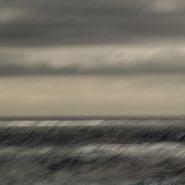
Drake Passage is the 500 mile wide body of water separating South America’s southern tip, Cape Horn, from Antarctica. It connects the southwestern part of the Atlantic Ocean (Scotia Sea) to the southeastern part of the Pacific Ocean and extends into the Southern Ocean. Named for the 16th-century English privateer, Sir Francis Drake, whose last remaining ship, after having passed through the Straight of Magellan, was blown far south in 1578, revealing an open connection between the Atlantic and Pacific oceans.
Chemical studies of fish teeth found in oceanic sedimentary rock confirm that Drake Passage was closed until about 40 million years ago. The separation of the two continents, created the Antarctic Circumpolar Current carrying a volume of water 600 times the flow of the Amazon River through Drake Passage, and around the Antarctic continent. And because this stretch of ocean circumvents the Earth without encountering any significant land masses, winds and waves can, and do build to incredible heights and force.
Before this passage opened some 40 million years ago, the Atlantic and Pacific Oceans were entirely separate, with Antarctica being much warmer and having no ice cap. The joining of these two great oceans created the Antarctic Circumpolar Current, cooling the Antarctic Continent significantly.
Since nothing has melted in Antarctica in millions of years, today the Antarctic continent contains 90% of the entire Earth’s ice.


Read More
2014
A year and a half ago, I spent two weeks along Antarctica’s northwest coast.
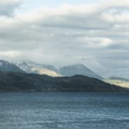
Flying to Buenos Aires and further south to Ushuaia, the ‘southernmost city in the world’ (Latitude 55 degrees S) which sits on the north bank of the Beagle Channel, the interior passage between the Atlantic and Pacific oceans. Named for Darwin’s ship that sailed this passage in 1831, the Beagle Channel separates Argentina’s very southern tip, the Tierra del Fuego archipelago, from Chile’s islands to the south.
Upon exiting the eastern end of Beagle Channel beyond Picton Island, Chile — a passage can then be set to cross the famed and feared 500 mile wide Drake Passage that separates South America from the ‘ice continent’.
Along the north side of Beagle Channel are lovely snow-covered mountains descending down to the water’s edge. Although this passage provides an inland route across Cape Horn, it is too narrow for sizeable ships to navigate its notoriously harsh and unpredictable weather.


Antarctica has this mythic weight. It resides in the collective unconscious of so many people, and it makes this huge impact, just like outer space. It’s like going to the moon.
—Jon Krakauer, Mountaineer and Author of Into Thin Air
A year and a half ago while visiting Alaska for the first time, I was taken by the monolithic glaciers. So extreme and so beautiful, I decided then that I had to visit Antarctica, home of the greatest mass of ice in the world!
 Antarctica, the fifth largest continent, is a very long way down there. It’s a fourteen-hour flight from Miami to the very tip of Argentina via Buenos Aires, and another two days by cruise ship providing the seas are relatively calm – so you need a pretty compelling reason to make the trek. Mine was seeing blue ice through the lens of my camera. On February 22, 2014, I boarded a plane in Albuquerque, NM, and began my three-week odyssey to the base of the earth. (more…)