2016
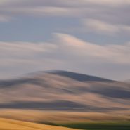
Ah, to be back on the road again, but not having to drive, so I can mesh this wonderful high country with our varying travel speeds, capturing the textured landscape that so speaks to me…


2016
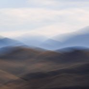
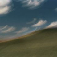
Heading home from Alberta to Santa Fe through the sweeping vistas and muted evening light of Western Montana.


2013
Beginning just south of Bozeman, MT, the Rocky Mountains’ north-south Gallatin Range, including 10 mountains above 10,000′ elevation, extends south 75 miles, averaging 20 miles wide, into the northwestern section of Yellowstone National Park. The Gallatin River flows north threading through Gallatin Valley. Opposite Gallatin Range, along the west side of the Gallatin Valley is the Madison Range. Along the eastern edge of the Gallatin Range the Yellowstone River flows north through Paradise Valley.
About midway between Gallatin Gateway and Yellowstone Park is the Big Sky ski resort situated in the Madison Range on 11,161′ Lone Mountain.
As US 191 heads south from Bozeman, the Gallatin Valley narrows dramatically as it begins to wind between the Gallatin and Madison ranges. Along the east side of Gallatin Valley, its foothills climb east up the Gallatin Range, while to the west Ted Turner’s 113,000 acre Flying D Ranch lies against the spectacular Spanish Peaks sub-range to the south, with its 11,015′ Gallatin Peak, and stretches from the Gallatin River west over the Madison Range to the Madison River at Ennis.
Gallatin Gateway is where the Gallatin Valley narrows to wind between the Gallatin and Madison ranges; a dear friend’s lovely ranch, perched on a south facing bench, provides wonderfully picturesque views of the melding of these three mountain ranges.


2013
The Absoraka-Beartooth Wilderness Area contains 30 peaks above 12,000′ elevation. As an integral part of the 20 million acre Greater Yellowstone Ecosystem, it borders Yellowstone National Park’s eastern side, straddling the Wyoming-Montana line and encompassing two distinct mountain ranges: the Beartooth Mountains, named after the likeness between a jagged mountain peak in the range and a bear’s tooth; and the Absorakas, named after the Crow Indians (Absoraka being the Indian name for crow).
Along the eastern side of the wilderness area, The Beartooths have the largest unbroken area of land within the lower 48 states in excess of 10,000 feet elevation. Comprised almost entirely of beautiful but fragile, high, treeless, bald granite plateaus interspersed by glacial lakes, the Beartooths include Montana’s highest mountain, the 12,799′ Granite Peak.
North of the Beartooths lies the Absaroka range’s stratified volcanic rocks, forested valleys and rugged peaks forming a chain of mountains that includes spectacular peaks east of Paradise Valley, beginning in Wyoming, including the Absoraka’s highest mountain, Francs Peak (13,153′), and continuing north into Montana.
Heading west from Red Lodge, Montana, (5,500′), US Route 212 goes up, down, and up again, for 70 incredibly tortuous miles along the Montana-Wyoming Border through the Beartooths; winding south into Wyoming just before the 10,947′ Beartooth Pass, (the highest road in the northern Rockies) and then back north into Montana over the 8,100′ Colter Pass, through Cooke City (6,400′), and finally climbing to Yellowstone’s NE entrance at 7,500’ elevation, once again in Wyoming.
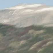
The views along the Beartooth Pass are spectacular and unnerving. Whether the high tundra mountain tops, or deep down in the incredibly steep valleys, the views are difficult to fathom.


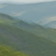
My first attempts at infusing the feeling of motion into my photographic images originated with my shooting moving objects – cars, trains, people walking or running. (more…)
Read More
1997
Needing an escape from urban living, I spent weeks in the solitude of Montana’s incredible high-country where I first experienced the grandeur of western landscape. It’s grand distances, unavailable in the Washington, DC parks, opened up a host of new possibilities in light, color and resolution that took me to a place I hadn’t experienced since the transatlantic ocean sailing days of my early twenties.


