2017
Dubrovnik’s long history of survival
For more than 3,000 years, the Adriatic has been the most practical trade route between Europe and the East. And for centuries, Croatia has been a buffer zone between east and west and between north and south.
Recorded history in Croatia starts with the Illyrians, a group of tribes that shared building and funeral techniques. By the 7th century BC, the Illyrians were trading with the ancient Greeks, and within two centuries the Greeks had established colonies in the area, notably Pharos (now Stari Grad) on the island of Hvar. By 229 BC, the Greeks were calling on Rome to help them in their quest to dominate the region.
In 1205 Dubrovnik came under Venetian control in the Adriatic, remaining under their sovereignty until 1358, when it became part of the Hungarian-Croatian kingdom. By then Dubrovnik was also becoming a trading state of increasing importance. Capitalizing on its fortunate position, Dubrovnik developed a strong seafaring tradition, eventually establishing trade routes all the way to Spain, Portugal and England.
In the early 14th century, after a huge fire destroyed most of Dubrovnik, a new urban plan was developed. At the beginning of the 15th century the remaining wooden houses in Dubrovnik were demolished and rebuilt in stone, in order to prevent fires from spreading.
By that time, Dubrovnik flourished as a haven of liberalism, allowing Dominicans and Franciscans within the city walls and offering asylum to refugees, including Jews, when many other cities turned them away at the gate. Dubrovnik abolished slavery in 1416, more than 400 years ahead of Britain (1833) and America (1863). Many slaves subsequently had their freedom bought for them by Dubrovnik nobles. The republics’s wealth was put to good use in a major building program.
Tragically, an earthquake destroyed most of the city in 1520, and the plague returned in force in 1528, killing more than 20,000 people. By the end of the 1520s, the Turks had pretty much defeated Hungary, and Dubrovnik was quick to change its allegiance from the Hungarian king to the Turkish sultan.
In 1588 Dubrovnik joined the Spanish in their ‘Invincible Armada’, losing a dozen of its finest ships and interrupting trade with Britain for nearly two centuries. New trade routes across the Atlantic made Britain, Spain and Portugal into wealthy nations; Mediterranean shipping was never to regain its former importance.
Disaster struck again in April 1667, when a massive earthquake destroyed Dubrovnik, killing more than 5,000 people, including the entire Minor Council and more than half of the Great Council. Dubrovnik’s massive rebuilding program continued through the early 18th century. By the end of the 18th century, Dubrovnik had regained a considerable amount of its wealth and standing.
Unfortunately, however, on May 26,1806, Napoleon broke a month-long siege by Russian and Montenegrin forces, and the republic allowed a French garrison to enter Dubrovnik. Once installed, the French didn’t leave. In 1809, Dubrovnik was absorbed into the newly created French ‘Illyrian Provinces’ stretching up the Adriatic Coast to Trieste. When Napoleon was finally defeated, Austria sent troops south and took control of Dubrovnik in 1814. A century later Dubrovnik became part of Yugoslavia.


Read More
2017
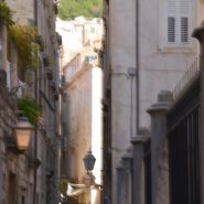
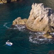
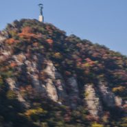
The biggest draw in Southern Croatia is the extraordinary walled city of Dubrovnik, with a remarkable history stretching back well over 1,000 years. Walls up to 80′ high, complete with fortresses and towers, with an ancient footpath along the 2 mile-long wall encircling the stone-built, red-roofed city, offer incredible views of the clearest blue-green waters of the Adriatic. The streets are paved with time-polished pale marble.
The town’s harmony owes much to the 17th century rebuilding program following the Great Earthquake in 1667.


2017
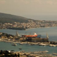
Zagreb is Croatia’s Capital and largest city, with a population of just over 800,000. Split is Croatia’s second largest city, and at 300,000 population the largest city within the Dalmatian region. Situated on the eastern shore of the Adriatic Sea, the city is spread out along a central peninsula.
Home to Diocletian’s Palace, built for the Roman emperor in AD 305, Split was founded as the Greek colony of Aspalathos in the 3rd or 2nd century BC. It became a prominent settlement around 650 AD when it succeeded the ancient capital of the Roman province, Solana.
Split became a Byzantine city, while later gradually drifting into the sphere of the Republic of Venice and the kingdom of Croatia. For much of the High and Middle ages, Split enjoyed autonomy as a free city, caught in the middle of a struggle between Venice and the King of Hungary for control over the Dalmatian cities.
Venice eventually prevailed and during the early modern period Split remained a Venetian city — a heavily fortified outpost surrounded by Ottoman territory. Its hinterland was won from the Ottomans in the Morean War of 1699; in 1797, as Venice fell to Napoleon in the Treaty of Campo Formio, Split went to the Hapsburg Monarchy. In 1805, the Peace of Pressburg added Split to the Napoleonic Kingdom of Italy, becoming part of the Illyrian Provinces in 1809. After being occupied in 1813, it was eventually granted to the Austrian Empire following the Congress of Vienna; the city remained a part of the Austrian Kingdom of Dalmatia until the fall of Austria-Hungary in 1918. Reoccupied by Germany in WWII, Split was part of the puppet State of Croatia. It was liberated again by partisans in 1944 and became part of post-war Socialist Yugoslavia. In 1991, Croatia seceded from Yugoslavia during the Croatian War of Independence.
Centrally situated along the Dalmatian Coast, over the last five years Split has become very much the center of Croatia’s rapidly-growing tourism trade, with its proximity to Italy, miles of Adriatic shore line and countless close and lovely Croatian islands. And its weather is classically Mediterranean!


2017
As the sun sets, Budapest’s Danube waterfront comes alive. Lights along its vast collection of memorial buildings and bridges announce and enhance this beautiful city’s main thoroughfare…


2017
Pest-Buda became a global city with the unification of Buda, Obuda, and Pest in 1873, with the name “Budapest” given to the new capital. Budapest also became the co-capital of the Austro-Hungarian Empire, a great power that dissolved in 1918, following WWI.
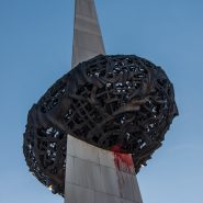
Upon entering Budapest from the south is the Statue of Liberty perched on top of Gellert Hill. First erected in 1947 in remembrance of the Soviet liberation of Hungary from Nazi forces during WWII, the 14 meter tall bronze statue stands atop a 26 meter pedestal holding a palm leaf.
Views of Budapest, overlooking the Danube River which runs North-South, separating what was once known as Pest along the west side of the Danube, and Buda, on the east side of the Danube. The hills on both sides of the Danube provide wonderful panoramics of the city. The Danube, located in Central and Eastern Europe, is Europe’s Second longest river after the Volga.
The House of Houdini memorializes Harry Houdini’s 1874 birth in Budapest. Upon immigrating to the U.S., he became a famous illusionist, known especially for his sensational escape artistry.


2017
From Venice we flew east to Bucharest to begin our 10 day Blue Danube River Cruise, west and then north to Budapest.
Bucharest, Romania’s capital and largest city, is situated in the southeast corner of the country, just north of the Danube River and the Bulgarian border. Between the two World Wars, Bucharest’s elegant architecture and the sophistication of its elite earned it the nickname of “Little Paris”.
Buildings and districts in the historic city center were heavily damaged or destroyed by war, earthquakes, but above all, by Nicholae Ceausescu’s 1965-1989 implementation of communist systemization. Today, Bucharest’s 2.4 million population makes it the seventh-largest city in the European Union.
Economically, Bucharest is the most prosperous city in Romania, and is one of the main industrial centers and transportation hubs of eastern and Central Europe.


2017
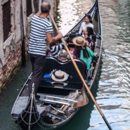
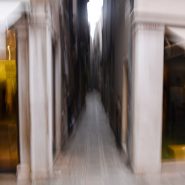
Continuing our wandering along Venice’s wonderful waterfronts…


2017
Just over a year ago, we took a month-long trip to Eastern Europe in October — the first stop being three days in Venice, where I had last been the summer after graduating from Berkeley 54 years ago, for about the same length of time. I was amazed how little it seemed to have changed. So, so charming, though there was now an awareness of the gradually rising sea levels, as numerous streets had moveable raised walkways for when the tide was high.
Of course, the food was wonderful, the Italian charm still overflowed, and it was very crowded as the weather was just delightful, and it was also the tail end of the Venice Biennale. So for three days we just ambled, taking it all in, photographing when the mood struck or a sight just had to be captured!


2016
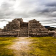
Fifteen miles west of San Miguel de Allende, situated on a small mesa surrounded by canyons, the Canada de La Virgen Pyramid was occupied between 500 and 1000 a.d. by the Otomi people, one of the many indigenous ethnic groups of the Middle American Indian population that inhabited the central plateau region of central Mexico.
The House of the Thirteen Heavens — which served as a horizon clock, an observatory, and a burial ground for the elite — was in perfect alignment with the sun, the moon, and all but one of the planets in our solar system at sunset during the Otomi New Year’s Eve, March 4, 2011, while the missing planet, Saturn, was situated precisely 180 degrees from the setting sun, just at the visual beginning of the ritual causeway to the site.
The interplay of the pyramid’s various-sized wall stones reflects the meticulous layout and care of the construction of this pyramid complex begun more than 1,000 years ago.


Read More
2016
Often likened to our very own Santa Fe, the small colonial city of San Miguel de Allende — 170 miles NW of Mexico City — was founded as “San Miguel” in 1542 by a San Franciscan monk, San Miguel El Grande. After it became the centerpiece in the war for Mexican independence from Spain, it was renamed San Miguel de Allende after Ignacio Allende, a hero of the independence movement.
This small city of 80,000 — situated along the Grand Plateau of Mexico, at 6,000+ feet elevation, between the eastern and western branches of the Sierra Madre Mountains — still thrives as the economic and cultural soul of Mexico. Spanish conquistadors ruled while the great colonial cities of Guadalajara, Morelia, Queretaro, Mexico City and Pueblo evolved during the Spanish silver mining era, later playing pivotal roles in the Mexican fight for independence.
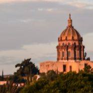
Situated on a steep hill, San Miguel’s El Centro opens onto a lovely plaza surrounded by wonderfully colorful facades amongst numerous exceptional churches. It’s narrow cobblestone streets complete its nearly 500 year history, preceding Santa Fe’s recently celebrated 400 year colonial history as our oldest state capital (founded in 1610, also by Spanish colonists). Although Santa Fe is 1,000′ higher than San Miguel, both benefit from year-round moderate temperatures and exceptional high desert light.


