2013
At 4,000′ elevation, the 275 square mile White Sands’ dune field comprises the world’s largest surface deposit of gypsum. Located 250 miles south of Albuquerque, and just north of the White Sands Missle Test Center, White Sands National Monument is situated in New Mexico’s Tularosa Basin between two 8-9,000′ North-South mountain ranges — the San Andreas Mountains to the west, and the Sacramento Mountains to the east.
The white gypsum sand is unlike typical desert sands made of quartz, or sand found on most beaches. Because the white gypsum reflects the sun’s rays resulting in a high rate of evaporation of surface moisture, the white gypsum sand is cool to the touch.
Because of southern New Mexico’s exceptionally clear weather, Germany trains their fighter pilots from an airbase 20 miles SE of White Sands; often they leave contrails that contrast dramatically against New Mexico’s blue, blue skies.


2011
Known for its picturesque, steep, undulating hills, ‘The Palouse’ encompasses the Palouse River watershed rising west out of north-central Idaho’s Blue Mountains to southeastern Washington State, where it turns south emptying into the Snake River.
The unique Palouse region was formed 30 million years ago as the Pacific Plate was pushed beneath the North American Plate, creating a chain of volcanoes that forced molten rock to erupt from cracks in western Oregon’s and Washington’s crust to form the Columbia Plateau basalts. Twenty million years later, the modern Cascade Range lifted up. Two million years ago, glaciers scoured the Pacific NW, generating volcanic silt (“loess”). Prevailing SW winds covered the Palouse’s lava floor with dunes as high as 200’ of wind-blown volcanic silt, resulting in the most fertile land in the northwest.
Lush grasslands provided prime winter grazing for the Nez Perce Indians’ painted ponies, the Appaloosas, until dry land farmers overran this land in the 1880’s. Contour-farming this fertile land for wheat and lentel beans, as high up the slopes as machinery allowed, the varying “painted” shapes have since traced these contours with the seasons’ beautiful patchwork.
Even more visually intriguing than from ground level, this landscape viewed from an isolated 1,000’ high quartzite ‘hill’, Steptoe Butte, offers spectacular aerial views of the Palouse hills.


Read More
2011
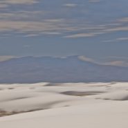
Situated within New Mexico’s south-central Tularosa Basin are 270 square miles of White Sands’ dunes comprising the world’s largest surface deposit of gypsum. Beginning 100 miles south of Albuquerque and continuing 100 miles further south to El Paso, this basin lies within the Rio Grande Rift zone and the Chihuahuan Desert.
Unlike typical quartz sand, gypsum sands’ high rate of surface moisture evaporation reflects rather than absorbs the sun’s rays, making the grains cool to the touch, while taking on the hues of first and last light.
Two hundred and fifty million years ago, enormous upheavals in the Rio Grande Rift formed mountain ranges on both the east and west edges of the Tularosa Basin that uncovered these gypsum deposits, which over time leached into the basin.
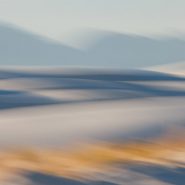
In the dunes foreground, sparse golden grasses glow in contrast to the brilliant white dunes which in turn contrast against the formidable mountains both east and west.


