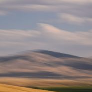
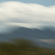
2016
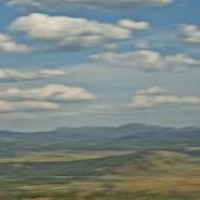
Heading home from Alberta to Santa Fe through the sweeping vistas and muted evening light of Western Montana.


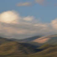
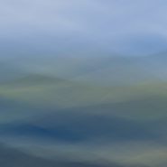
2016
Heading south along the Icefields Parkway, returning from Jasper — again paralleling the Columbia ice fields —the views of the Canadian Rockies are just as incredible, modulated only by the sun’s direction and time of day…


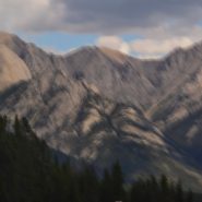
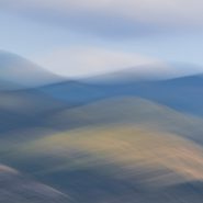
2016
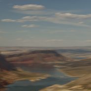
Ninety minutes west of Calgary, Banff & Lake Louise begins Alberta’s spectacular 150 mile Icefields Parkway drive from Banff north to Jasper — ranked by National Geographic as one of the top 10 drives in the world. Certainly the most dramatic in Canada, it parallels the Continental Divide and the Columbia ice fields at an elevation of about 6,000′ through the magnificent Canadian Rockies.


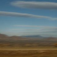
2015
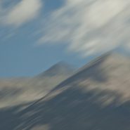
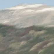
From 20 miles north of Santa Fe, my third and final series of the west face of the Sangre de Cristo mountain range. President Clinton was fond of saying, “its the economy stupid!”
Well, in photography, it’s all about the light…
On this day, the sun was “out full bore,” and because my captures were slightly earlier in the day, the sun still cleared the Jemiz Mountain range behind me; sunlight shined directly on Santa Fe Baldy, the highest peak in this section of the range. Blending the highlighted west face amongst its shadowed surroundings offered a very different series of compositions.


2015
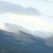
Another series of captures from “my” 8,500′ ridge vantage point, 20 miles north of Santa Fe, offers dramatic “takes” of the Sangre’s west face — including its foothills — leading up to its 12,000′ peaks perched under a late afternoon sky.
As direct sunlight still bathes the nearby foothills, the receding Sangre peaks read as a distant blue line of demarcation that separate the Blood of Christ ridge from the Western cloud-laden sky. These three receding horizontal elements of color and texture afford an array of blending possibilities…


2015
Returning to one of my favorite New Mexico palettes — just twenty miles north of my home in Santa Fe — an accessible 8,500 foot ridge offers unobstructed views across the 2-3 mile wide valley directly into the entire west face of the Blood of Christ mountain range, from its foothills all the way up and beyond its 12,000′ peaks, which are so often crowned with a continuously-modulating cloud cap as the evening light descends.
An always-varying palette of color, shadow, texture and form…


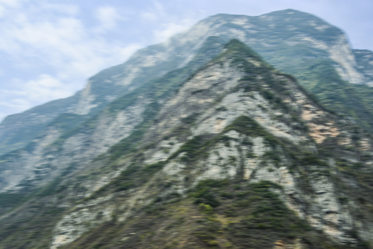
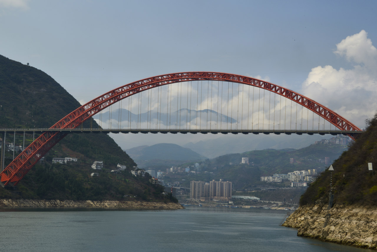
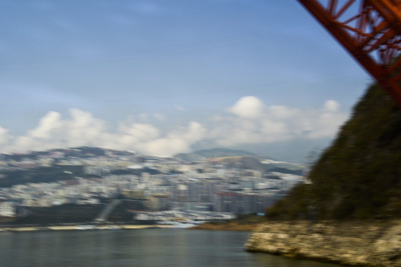
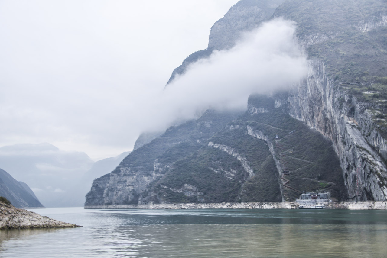
2015
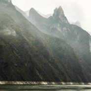
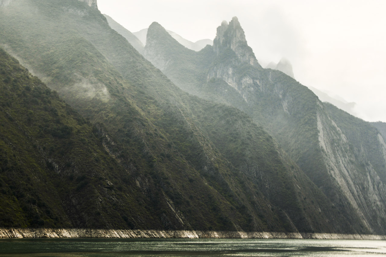
For nearly 4,000 miles, The Yangtze River, together with its 700 tributaries, is China’s largest water system and is historically, economically and culturally critical to the Earth’s most populated country. Flowing out of the barren snowfields of western Tibet, the Yangtze River begins on the Qinghai-Tibet Plateau, where it is fed by glaciers in The Tanggula Mountain Range (highest peak, Geladandong, at 21,722 feet) in far western China and loops far south and then east through eight provinces — Sichuan, Yunnan, Chongqing, Hubei, Hunan, Jiangxi, Anhui, and Jiangsu — and just north past Shanghai into the East China Sea.
The Yangtze River is the third longest in the world — after the Nile and the Amazon — and the busiest river in Asia. The Yangtze River Basin comprises an enormous granary for China. Major cities on the Yangtze River, from west, south and east, are Chongqing, Yichang, Wuhan, Nanjing and Shanghai. And its just-completed Three Gorges Dam is the largest dam in the world.
2014
This is the third and final series of the Ortiz Mountains. In each of these images, I have stroked the camera ‘with the grain,’ while simultaneously also stroking ‘cross-grain;’ the resultant complex-curve pans, enable me to add depth and volume to these images which I like to think of as my own single-frame ‘Virtual Realities.’


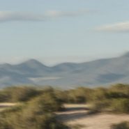
2014
A while back, I had the opportunity to ‘house-sit’ for friends who live on a ridge overlooking the Ortiz Mountains in the southern quadrant of Galisteo Basin, twenty miles south of my home in Santa Fe. Three weeks of this particular view gave me the opportunity to pursue different visual themes of the Ortiz: more or less straightforward photographic capture, plus overlaying the scene with varying motion strokes to stretch, and cross-cut the scene; and then to incorporate dramatic first and last New Mexico light to once again re-integrate my strokes.


2013
Twelve years ago I moved from Maryland’s very flat, eastern shore to Santa Fe to live amongst beautiful mountains bathed by incredible high desert light. Yet I still can’t quite believe the anomaly that is the 4,500′ Bosque del Apache wetlands preserve.
The wetlands’ color and texture magically blend against the Chupadera mountains’ 7,000′ east face during the sun’s morning ascent.


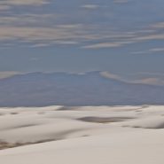
2013
At 4,000′ elevation, the 275 square mile White Sands’ dune field comprises the world’s largest surface deposit of gypsum. Located 250 miles south of Albuquerque, and just north of the White Sands Missle Test Center, White Sands National Monument is situated in New Mexico’s Tularosa Basin between two 8-9,000′ North-South mountain ranges — the San Andreas Mountains to the west, and the Sacramento Mountains to the east.
The white gypsum sand is unlike typical desert sands made of quartz, or sand found on most beaches. Because the white gypsum reflects the sun’s rays resulting in a high rate of evaporation of surface moisture, the white gypsum sand is cool to the touch.
Because of southern New Mexico’s exceptionally clear weather, Germany trains their fighter pilots from an airbase 20 miles SE of White Sands; often they leave contrails that contrast dramatically against New Mexico’s blue, blue skies.


2013
Twenty miles northeast of Alamosa, at the very southern end of the more extensive Sangre de Cristo range, Blanca Peak, at 14,351′, is the highest summit of the Sierra Blanca Massif, the Sangre de Cristo Mountains, as well as the highest point within the Rio Grande’s entire drainage basin. In addition to being the fourth highest peak in Colorado, Blanca Peak is higher than any point east in the U.S.
Known to the Navajo nation as the Sacred Mountain of the East, Blanca Peak is considered to be the eastern boundary of the Dinetah, the traditional Navajo homeland.


2013
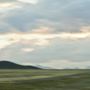
San Luis Valley — 8,000 sq. miles, averaging 7,600′ elevation — is the largest high desert valley in North America. Situated in south central Colorado, with a small portion extending south into central New Mexico, this gradually-sloping, 122 mile long north-to-south flat basin, 74 miles wide, separates Colorado’s two largest mountain ranges – the San Juans to the west, and the Sangre de Cristos to the east.
As part of the Rio Grande Rift, San Luis Valley extends east from the Continental Divide. The Rio Grande River rises out of the eastern San Juan Mountains and flows south into New Mexico; Colorado rivers west of the Continental Divide are drained by the Colorado River. Receiving little precipitation, the San Luis Valley is comprised of desert lands; with no clear southern boundary, it is generally considered to include the San Luis Hills of southern Colorado and the Taos Plateau of northern New Mexico.
Along the eastern edge of San Luis Valley are two significant features:
Blanca Peak, at 14,351′, is the fourth highest mountain in Colorado, and the highest peak in the Sangre de Cristo Mountains. Situated at the southern end of the more extensive Sangre de Cristo Range, it is the highest peak in both ranges, and is located 20 miles east-northeast of the town of Alamosa. Blanca Peak is also the highest point of the entire drainage basin of the Rio Grande, and is higher than any point in the U.S. east of its longitude.
Fifteen miles northwest of Blanca Peak, the Great Sand Dunes National Park and Preserve is situated in the lee of the Sangre de Cristos. These sand dunes, reaching as high as 750′, are the highest in North America.


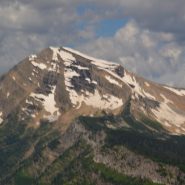
2013
At 12,095′ elevation, this narrow strip of the Continental Divide is the high and extensive Sawatch Range of the Rocky Mountains of central Colorado. Situated midway between Aspen and Twin Lakes, it includes eight of the twenty highest Rocky Mountain peaks. Independence Pass is the highest paved crossing of the Continental Divide in the US.
Overlooking the alpine tundra environment above the treeline, Independence Pass offers incredible views east of Mt. Elbert, Colorado’s highest peak, and the second highest mountain in the contiguous United States.


2013
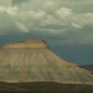
Mount Garfield at 6,780′ elevation is the high point of the Book Cliffs range — a series of desert mountains and cliffs stretching 200 miles from western Colorado into eastern Utah, north of Grand Junction. Appearing primarily along the southern and western edge of the Tavaputs Plateau, these cliffs are largely composed of sedimentary materials that cap many of the south-facing buttes, appearing similar to a shelf of books.
Within the Colorado Plateau geologic province, these cliffs of Cretaceous sandstone begin where the Colorado River descends south through De Beque Canyon into the Grand Valley before running west to Price Canyon near Helper, UT.


2013
The Green River is both the inflow and outflow of Flaming Gorge Reservoir, whose elevation when full is 6,040′. Created in 1964 by the completion of the Flaming Gorge Dam, the reservoir is mostly situated in Wyoming, as its northern tip is only 14 miles southwest of Rock Springs, WY. Just its southern end dips into northeastern Utah.
Rising out of western Wyoming’s Wind River Mountains, the Green River is the principal tributary of the Colorado River. During John Wesley Powell’s 1869 expedition down the Green River, he named the Flaming Gorge for its spectacular red sandstone cliffs surrounding this part of the river. The Green River continues south through Utah, before it merges with the Colorado River 40 miles into western Colorado.


Read More
2013
Another Rocky Mountain range in Western Wyoming, The Winds run generally NW-SE for about 100 miles, and include more than 40 peaks in excess of 13,000′. Gannett Peak, at 13,809′ is the highest mountain in Wyoming, though only 33′ higher than the 13,776′ Grand Teton. Except for Grand Teton, the next 19 highest peaks in Wyoming, are in The Winds. Two National Forests and three wilderness areas encompass most of the Wind River Range, as the Continental Divide follows its crest.
Shoshone National Forest on its east side, and Bridger-Teton National Forest to the west, and the entire Wind River range, are all part of the Greater Yellowstone Ecosystem. Portions of the range are also within the Wind River Indian Reservation.
Indigenous peoples of the Great Basin, such as the Shoshones and Absarokas (Crow) Native Americans lived in the range beginning 7,000 and 9,000 years ago.


2013
The Rocky Mountains’ north-south Teton Range includes 9 peaks in excess of 11,000′ elevation, with Grand Teton being the highest at 13,770′. Beginning just south of Yellowstone National Park, the Teton Range is situated primarily on the Wyoming side of the state border with Idaho, with most of the range’s east slope located in the Grand Teton National Park.
This area, 2.5 billion years ago, was an ancient ocean that gradually filled with sand and volcanic debris. As additional sediment deposited over millions of years, heat and pressure metamorphosed this sediment into gneiss, until eventually magma was forced up through the cracks in the gneiss to form granite, anywhere from inches to hundreds of feet thick.
Then, 6-10 million years ago, stretching and thinning of the Earth’s crust caused movement along the Teton fault: as the fault line’s west block rose to create the Teton Range – the youngest of the Rocky Mountains — the fault’s east block collapsed forming the valley called Jackson Hole.
While the west side of the Teton Range appears as high rolling hills transitioning smoothly into flat pasture, the Teton’s spectacular east-facing granite slope — too young to have eroded into soft hills, and without lower peaks to obscure it — rises dramatically 5,000 to 7,000′ above the valley floor.


2013
Beginning just south of Bozeman, MT, the Rocky Mountains’ north-south Gallatin Range, including 10 mountains above 10,000′ elevation, extends south 75 miles, averaging 20 miles wide, into the northwestern section of Yellowstone National Park. The Gallatin River flows north threading through Gallatin Valley. Opposite Gallatin Range, along the west side of the Gallatin Valley is the Madison Range. Along the eastern edge of the Gallatin Range the Yellowstone River flows north through Paradise Valley.
About midway between Gallatin Gateway and Yellowstone Park is the Big Sky ski resort situated in the Madison Range on 11,161′ Lone Mountain.
As US 191 heads south from Bozeman, the Gallatin Valley narrows dramatically as it begins to wind between the Gallatin and Madison ranges. Along the east side of Gallatin Valley, its foothills climb east up the Gallatin Range, while to the west Ted Turner’s 113,000 acre Flying D Ranch lies against the spectacular Spanish Peaks sub-range to the south, with its 11,015′ Gallatin Peak, and stretches from the Gallatin River west over the Madison Range to the Madison River at Ennis.
Gallatin Gateway is where the Gallatin Valley narrows to wind between the Gallatin and Madison ranges; a dear friend’s lovely ranch, perched on a south facing bench, provides wonderfully picturesque views of the melding of these three mountain ranges.


2013
The Absoraka-Beartooth Wilderness Area contains 30 peaks above 12,000′ elevation. As an integral part of the 20 million acre Greater Yellowstone Ecosystem, it borders Yellowstone National Park’s eastern side, straddling the Wyoming-Montana line and encompassing two distinct mountain ranges: the Beartooth Mountains, named after the likeness between a jagged mountain peak in the range and a bear’s tooth; and the Absorakas, named after the Crow Indians (Absoraka being the Indian name for crow).
Along the eastern side of the wilderness area, The Beartooths have the largest unbroken area of land within the lower 48 states in excess of 10,000 feet elevation. Comprised almost entirely of beautiful but fragile, high, treeless, bald granite plateaus interspersed by glacial lakes, the Beartooths include Montana’s highest mountain, the 12,799′ Granite Peak.
North of the Beartooths lies the Absaroka range’s stratified volcanic rocks, forested valleys and rugged peaks forming a chain of mountains that includes spectacular peaks east of Paradise Valley, beginning in Wyoming, including the Absoraka’s highest mountain, Francs Peak (13,153′), and continuing north into Montana.
Heading west from Red Lodge, Montana, (5,500′), US Route 212 goes up, down, and up again, for 70 incredibly tortuous miles along the Montana-Wyoming Border through the Beartooths; winding south into Wyoming just before the 10,947′ Beartooth Pass, (the highest road in the northern Rockies) and then back north into Montana over the 8,100′ Colter Pass, through Cooke City (6,400′), and finally climbing to Yellowstone’s NE entrance at 7,500’ elevation, once again in Wyoming.
The views along the Beartooth Pass are spectacular and unnerving. Whether the high tundra mountain tops, or deep down in the incredibly steep valleys, the views are difficult to fathom.


