2013
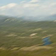
The Snake River’s headwaters are formed at the consolidation of three tiny streams, at an elevation of nearly 9,000′, on the southwest flank of Two Oceans Plateau situated in western Wyoming’s portion of Yellowstone National Park.
Flowing south through Jackson Lake, the ninth longest river in the US continues on south through Jackson Hole valley between the Tetons and Wind River Range, before making a large western sweep through southern Idaho’s Snake River Canyon, and then northwest through Oregon and Washington, where it becomes the Columbia River’s largest tributary, as well as the largest North American river to empty into the Pacific Ocean.
Looking east from the Tetons – the Snake continues its 1,078 mile journey to the Pacific — between the Tetons and The Wind River Range — as it flows south through Jackson Hole.


2013
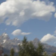
The Rocky Mountains’ north-south Teton Range includes 9 peaks in excess of 11,000′ elevation, with Grand Teton being the highest at 13,770′. Beginning just south of Yellowstone National Park, the Teton Range is situated primarily on the Wyoming side of the state border with Idaho, with most of the range’s east slope located in the Grand Teton National Park.
This area, 2.5 billion years ago, was an ancient ocean that gradually filled with sand and volcanic debris. As additional sediment deposited over millions of years, heat and pressure metamorphosed this sediment into gneiss, until eventually magma was forced up through the cracks in the gneiss to form granite, anywhere from inches to hundreds of feet thick.
Then, 6-10 million years ago, stretching and thinning of the Earth’s crust caused movement along the Teton fault: as the fault line’s west block rose to create the Teton Range – the youngest of the Rocky Mountains — the fault’s east block collapsed forming the valley called Jackson Hole.
While the west side of the Teton Range appears as high rolling hills transitioning smoothly into flat pasture, the Teton’s spectacular east-facing granite slope — too young to have eroded into soft hills, and without lower peaks to obscure it — rises dramatically 5,000 to 7,000′ above the valley floor.


2013
Beginning just south of Bozeman, MT, the Rocky Mountains’ north-south Gallatin Range, including 10 mountains above 10,000′ elevation, extends south 75 miles, averaging 20 miles wide, into the northwestern section of Yellowstone National Park. The Gallatin River flows north threading through Gallatin Valley. Opposite Gallatin Range, along the west side of the Gallatin Valley is the Madison Range. Along the eastern edge of the Gallatin Range the Yellowstone River flows north through Paradise Valley.
About midway between Gallatin Gateway and Yellowstone Park is the Big Sky ski resort situated in the Madison Range on 11,161′ Lone Mountain.
As US 191 heads south from Bozeman, the Gallatin Valley narrows dramatically as it begins to wind between the Gallatin and Madison ranges. Along the east side of Gallatin Valley, its foothills climb east up the Gallatin Range, while to the west Ted Turner’s 113,000 acre Flying D Ranch lies against the spectacular Spanish Peaks sub-range to the south, with its 11,015′ Gallatin Peak, and stretches from the Gallatin River west over the Madison Range to the Madison River at Ennis.
Gallatin Gateway is where the Gallatin Valley narrows to wind between the Gallatin and Madison ranges; a dear friend’s lovely ranch, perched on a south facing bench, provides wonderfully picturesque views of the melding of these three mountain ranges.


2013
Originally referred to as the East Fork of the Yellowstone River, the 40 mile long Lamar River rises out of the Absaroka Range along the eastern border of Yellowstone National Park, and meanders northwest and then west to where it flows into the Yellowstone River south of the Montana Border. The wide, expansive Lamar Valley is home to bison, elk, coyote, grizzly and wolf.
In 1995, wolves were re-introduced in the northeast corner of Yellowstone Park along the Lamar River at Soda Butte, Crystal Creek and Rose Creek.


2013
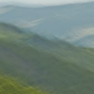
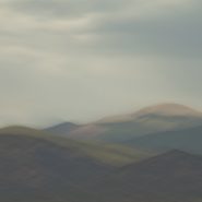
The Absoraka-Beartooth Wilderness Area contains 30 peaks above 12,000′ elevation. As an integral part of the 20 million acre Greater Yellowstone Ecosystem, it borders Yellowstone National Park’s eastern side, straddling the Wyoming-Montana line and encompassing two distinct mountain ranges: the Beartooth Mountains, named after the likeness between a jagged mountain peak in the range and a bear’s tooth; and the Absorakas, named after the Crow Indians (Absoraka being the Indian name for crow).
Along the eastern side of the wilderness area, The Beartooths have the largest unbroken area of land within the lower 48 states in excess of 10,000 feet elevation. Comprised almost entirely of beautiful but fragile, high, treeless, bald granite plateaus interspersed by glacial lakes, the Beartooths include Montana’s highest mountain, the 12,799′ Granite Peak.
North of the Beartooths lies the Absaroka range’s stratified volcanic rocks, forested valleys and rugged peaks forming a chain of mountains that includes spectacular peaks east of Paradise Valley, beginning in Wyoming, including the Absoraka’s highest mountain, Francs Peak (13,153′), and continuing north into Montana.
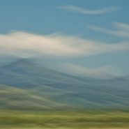
Heading west from Red Lodge, Montana, (5,500′), US Route 212 goes up, down, and up again, for 70 incredibly tortuous miles along the Montana-Wyoming Border through the Beartooths; winding south into Wyoming just before the 10,947′ Beartooth Pass, (the highest road in the northern Rockies) and then back north into Montana over the 8,100′ Colter Pass, through Cooke City (6,400′), and finally climbing to Yellowstone’s NE entrance at 7,500’ elevation, once again in Wyoming.
The views along the Beartooth Pass are spectacular and unnerving. Whether the high tundra mountain tops, or deep down in the incredibly steep valleys, the views are difficult to fathom.


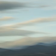
2014
The tenth and final successive exploration (at least for now) of the west face of Santa Fe Baldy’s portion of the Sangre de Cristo range, immediately north of Santa Fe.
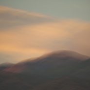
Eight months since my last exploration, the setting sun, through clouds scattered over the Jemez range 20 miles west, slowly diffuses Santa Fe Baldy’s own atmospherics.


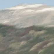
2013
The 9th of ten successive explorations of the Santa Fe Baldy portion of the Sangre de Cristo range, immediately north of Santa Fe.
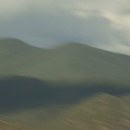
Winter’s earlier, crisper light emphasizes Santa Fe Baldy’s west face, especially when framed with low hanging clouds.


2013
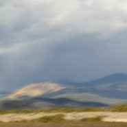
As winter sets in I continue my visual explorations of the Sangre de Cristo mountain ridge surrounding New Mexico’s 4th highest peak, Santa Fe Baldy.
Blending the snow-covered mountains’ more subtle palette allows for a very different interpretation…


2013
Continuing my visual explorations just north of Santa Fe, as the weather turns, the contrast of light, clouds and first snow intensifies against the 12,000′ Sangre de Cristo mountain ridge that surrounds New Mexico’s 4th highest peak, Santa Fe Baldy.
In turn, this further reduction of my blended elements to three emphasizes how I see and interpret this landscape.


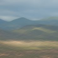
2013
I’m now half-way through introducing the results of my visual exploration of the 12,000′ Sangre de Cristo mountain ridge clustered around Santa Fe Baldy, New Mexico’s 4th highest peak, just north of Santa Fe.
Reducing the variables in each image – shooting from the same location, and at nearly the same time – reveals not only what I am seeing, but how I am seeing. Blending my motion-strokes against the mountain tops emphasizes the light’s particular hue, and how that hue casts upon Santa Fe Baldy.
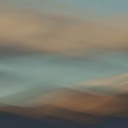
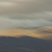
2013
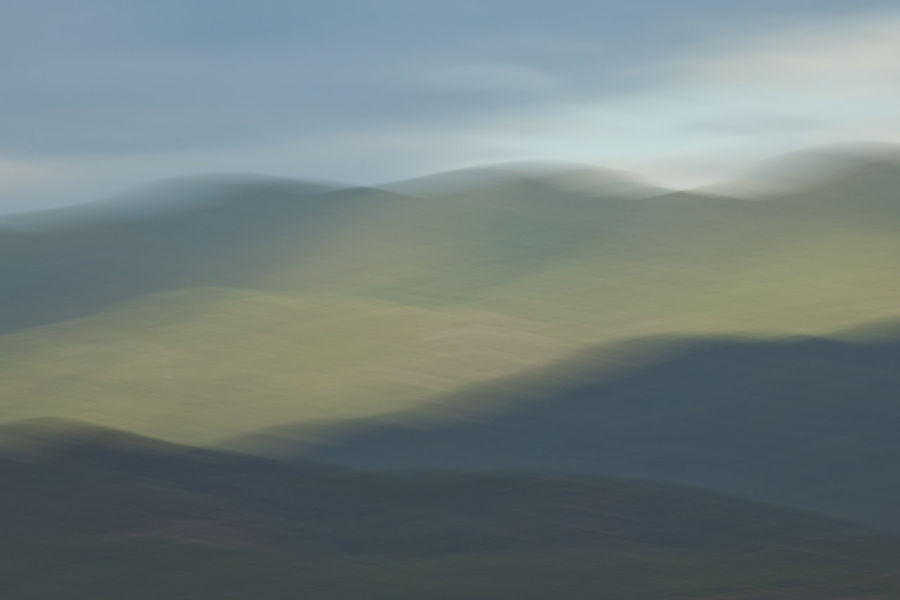
This is the fifth of ten successive explorations of light’s effect on the Santa Fe Baldy portion of the Sangre de Cristo mountain range, just north of Santa Fe. At 12,632′ elevation, Santa Fe Baldy is especially susceptible to ‛nearly last light,’ particularly when nearby clouds take on hues that compliment the mountain peak.


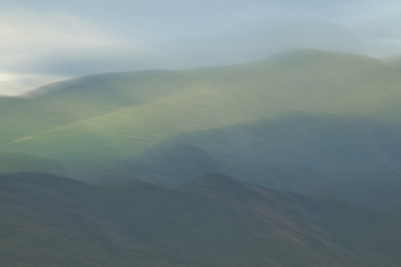
2013
The fourth of ten successive explorations of the Santa Fe Baldy portion of the Sangre de Cristo range, just north of Santa Fe.


2013
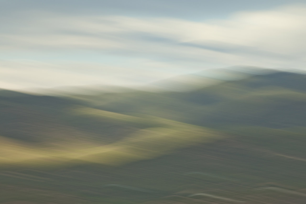
This is the third of my ten successive explorations of the Santa Fe Baldy portion of the Sangre de Cristo range, just north of Santa Fe. Captured with slightly earlier afternoon light, filtered with some cloud cover, the lower contrast of these images offers a closer examination of the blended hues of the foothills against the ridge lines.


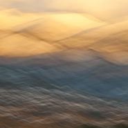
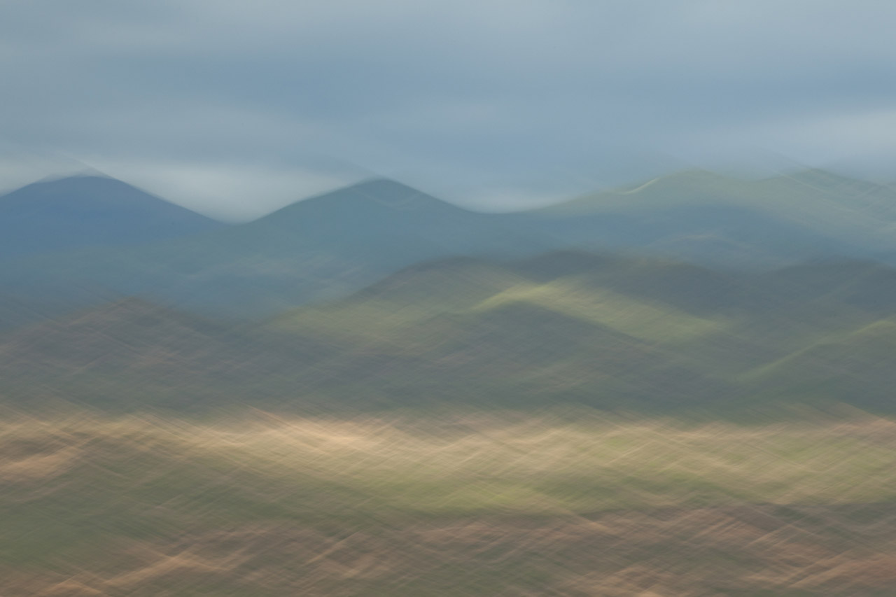
2013
Returning for the second time to my “new best” vantage point, just north of Santa Fe, to capture the Sangres surrounding Santa Fe Baldy, New Mexico’s 4th highest peak, this time at early light; “my ridge” first presents the sun breaking behind the peaks, before lighting up the early clouds in concert with the ridge lines.
I’m expecting that this extended exploration of the light’s effect on this same section of the Sangre peaks will provide me a narrow comparative study which I have not attempted before.


2013
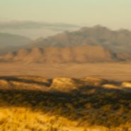
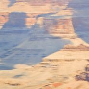
Stretching over 1,000 miles, the Rio Grande/Rio Bravo forms the international boundary between the United States and Mexico. Named for the southernmost 118 mile U-shaped bend in the Rio Grande, Big Bend National Park’s 1,250 sq. miles means it is larger than the state of Rhode Island.
Lying in a southwest – northeast axis, the 20 mile long Chisos Mountain range is the furthest southern mountain range in the U.S. Its 7,835′ Emory Peak is the highest of its four peaks that exceed 7,000′.
The Chisos Mountains, initially amongst a surrounding lowland formed some 66 million years ago, was uplifted 30 million years later. Followed by very active volcanism, the high basalt content offers a wide range of beautifully subtle hued formations.
I found I just couldn’t resist the texture, color and shape of the Chisos Mountains basalt formations…


2012
Just south of Santa Fe at the southern terminus of the Rocky Mountains, the Galisteo Basin begins a 2,500′ elevation descent south over 40 miles to the Sandias adjacent to Albuquerque; And to the west it stretches beyond the Rio Grande Rift to the southern end of the foothills of the Jemez Mountains.
Surrounded by these three mountain ranges, the Galisteo Basin’s classic northern New Mexico high desert landscape offers dramatic views in all directions. Having introduced three Galisteo Basin image series captured in 2011, this posting comprises a series of the Galisteo Basin captured from a morning helicopter flight in 2012.
To view more images of the Galisteo Basin, see Galisteo Basin I, Galisteo Basin II and Galisteo Basin III.


2012
The Sangre de Cristo (Blood of Christ) Mountain range is the southernmost subrange of the Rockies; they begin in Southern Colorado and extend south to just below Santa Fe. At the north end of town, on the Sangre’s western slope is Santa Fe Mountain, whose west face is covered with very large Aspen stands.
Native to cold regions with cool summers at altitudes above 5,000 feet, aspens are medium-sized deciduous trees reaching as high as 100′. They generally grow in large colonies derived from a single seedling and spread by means of root suckers whose new stems may appear more than 100 feet from the parent tree. While each individual tree can live for 40 to 150 years, they send up new trunks as the older trunks die off above ground, so their root systems are long-lived, in some cases for thousands of years, which is why aspen stands are considered to be ancient woodlands.
Come the end of September through mid-October, the west face of Santa Fe Mountain lights up as the Aspen leaves turn their beautiful, riotous, yellow. Illuminated by the lower angle of fall sunsets, the light is just magical.


Read More
For me, landscape reflects the ultimate passage of time. Although Earth is thought to be 4.5 billion years old, almost no portion of it is visible in the landscape today. (more…)
Read More
My first attempts at infusing the feeling of motion into my photographic images originated with my shooting moving objects – cars, trains, people walking or running. (more…)
Read More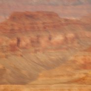
2011
Soft Canyon Light
I have celebrated New Year’s Eve 2011 and 2012 at the Grand Canyon’s South Rim, shooting the very last light of the year as well as the new year’s very first light. Winter light’s low angle muted with clouds creates such a soft palette, which when lucky enough to also have some snow, softens the canyon even further.
The cold and the silence seem to further soften the winter light, and without thermals, even the ravens are quiet, though still appearing to stand guard along the rim.
This is my ninth consecutive year capturing one of the world’s most iconic landscapes. In one glimpse you can see a third of the Earth’s history layered a mile deep into the canyon. To convey that feeling of elapsed time within single images encompasses my most thrilling moments as an interpretative landscape photographer.


Read More