2013
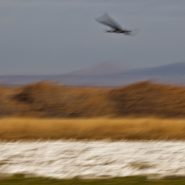
Tens of thousands of snow geese and as many as 15,000 sandhill cranes begin arriving mid-November to rest and refuel from their long southern migration flights. Most will stay until the end of January, spending each night safe from predators in 2-to-3 feet of marsh water. At dawn, the snow geese begin stirring; soon their honking and flapping of wings raises to such a din, flock after flock lift off, ‛flying out’ to the surrounding fields to feed. As the sun sets, they return to the wetlands for the night.
This time of year thousands of people are drawn to Bosque Apache to witness this twice daily incredible ‛sight, sound, and motion’ show, which is further enhanced by the low-angled winter sun as the birds circle against the 7,000′ Chupadera Mountains.


2013
Originally referred to as the East Fork of the Yellowstone River, the 40 mile long Lamar River rises out of the Absaroka Range along the eastern border of Yellowstone National Park, and meanders northwest and then west to where it flows into the Yellowstone River south of the Montana Border. The wide, expansive Lamar Valley is home to bison, elk, coyote, grizzly and wolf.
In 1995, wolves were re-introduced in the northeast corner of Yellowstone Park along the Lamar River at Soda Butte, Crystal Creek and Rose Creek.


2013
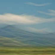
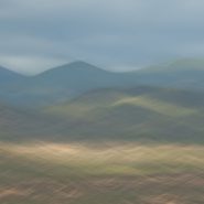
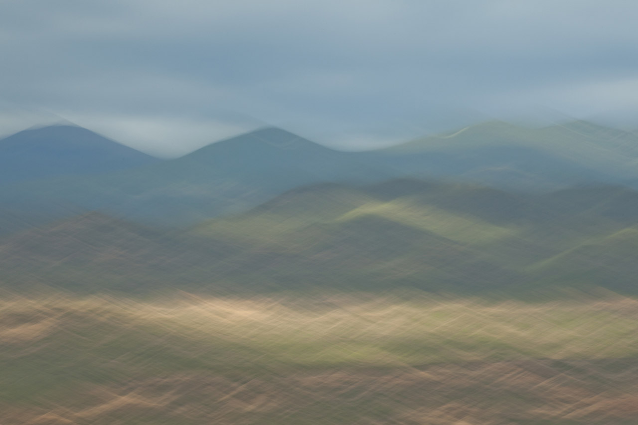
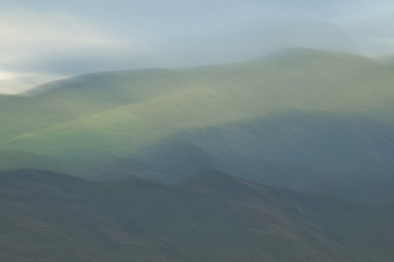
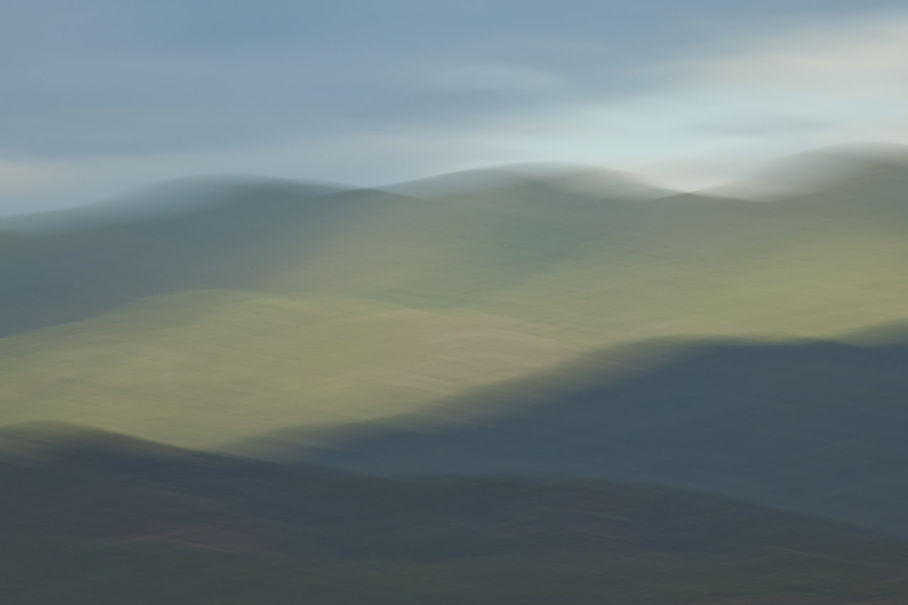
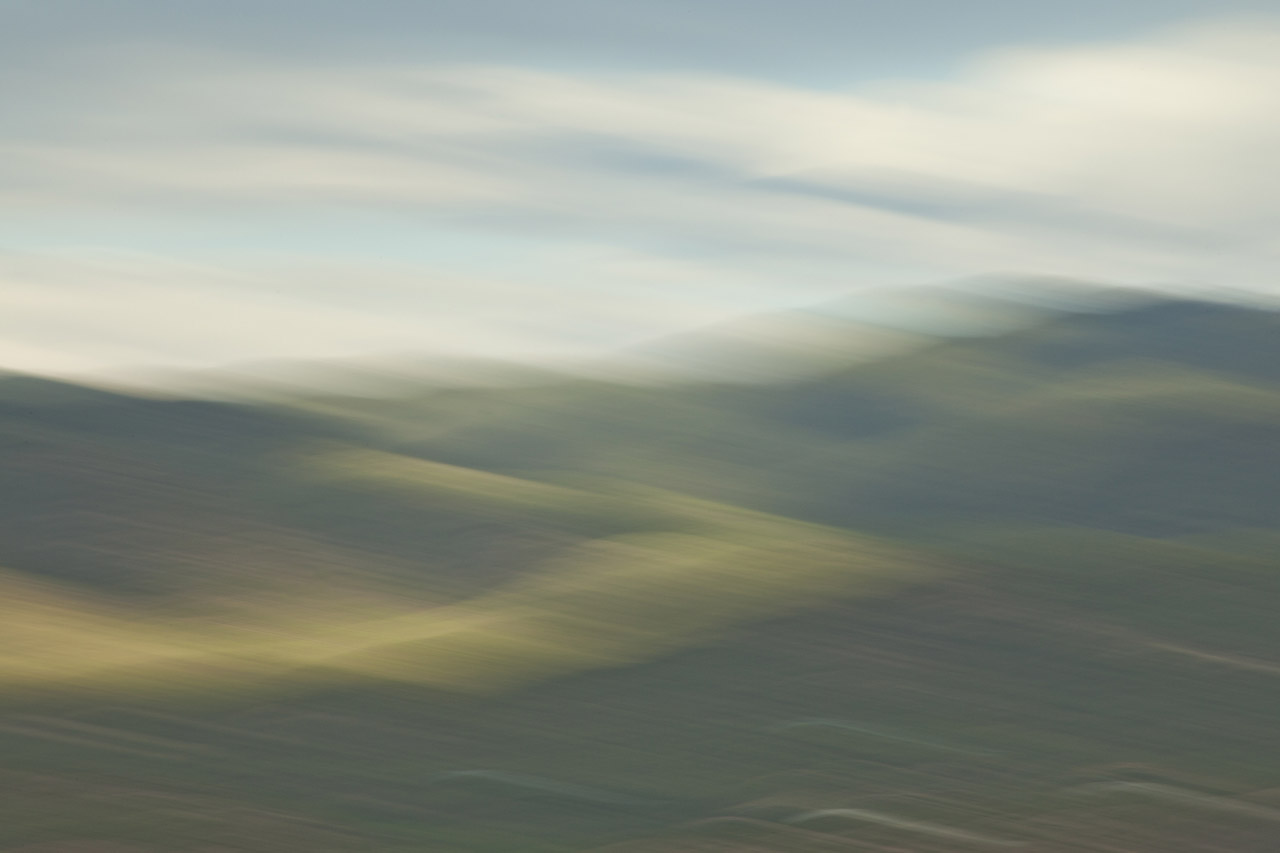
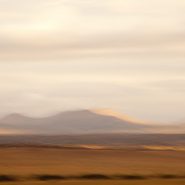
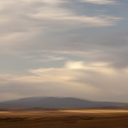
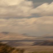
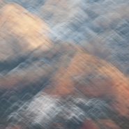
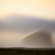
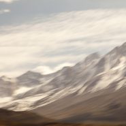
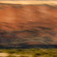
I’m now half-way through introducing the results of my visual exploration of the 12,000′ Sangre de Cristo mountain ridge clustered around Santa Fe Baldy, New Mexico’s 4th highest peak, just north of Santa Fe.
Reducing the variables in each image – shooting from the same location, and at nearly the same time – reveals not only what I am seeing, but how I am seeing. Blending my motion-strokes against the mountain tops emphasizes the light’s particular hue, and how that hue casts upon Santa Fe Baldy.
Read More
2013
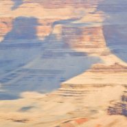
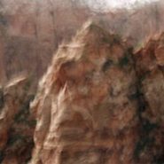
Stretching over 1,000 miles, the Rio Grande/Rio Bravo forms the international boundary between the United States and Mexico. Named for the southernmost 118 mile U-shaped bend in the Rio Grande, Big Bend National Park’s 1,250 sq. miles means it is larger than the state of Rhode Island.
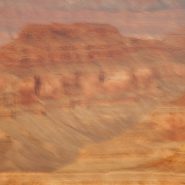
Lying in a southwest – northeast axis, the 20 mile long Chisos Mountain range is the furthest southern mountain range in the U.S. Its 7,835′ Emory Peak is the highest of its four peaks that exceed 7,000′.
The Chisos Mountains, initially amongst a surrounding lowland formed some 66 million years ago, was uplifted 30 million years later. Followed by very active volcanism, the high basalt content offers a wide range of beautifully subtle hued formations.
I found I just couldn’t resist the texture, color and shape of the Chisos Mountains basalt formations…


2013
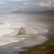
Stretching across Kauai’s northern end, the Na Pali coast’s steep, dramatic terrain is rimmed with narrow beaches and booming surf. It’s vivid colors range from the lush tropical greens to the island’s red, oxidized basaltic foundation and a myriad of colors in between. The crystal clear sunlight intermittently filtered by the voluminous clouds adds a vast and brilliant pacific blue border for this magnificent coast.
I have yet to have a bad day – light wise or cloud-wise – on Kauai! Having lived for the last ten years in the southwest’s high desert country, it was truly a luxury…


2011
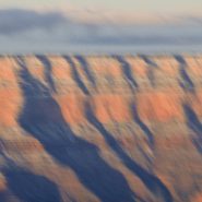
Soft Canyon Light
I have celebrated New Year’s Eve 2011 and 2012 at the Grand Canyon’s South Rim, shooting the very last light of the year as well as the new year’s very first light. Winter light’s low angle muted with clouds creates such a soft palette, which when lucky enough to also have some snow, softens the canyon even further.
The cold and the silence seem to further soften the winter light, and without thermals, even the ravens are quiet, though still appearing to stand guard along the rim.
This is my ninth consecutive year capturing one of the world’s most iconic landscapes. In one glimpse you can see a third of the Earth’s history layered a mile deep into the canyon. To convey that feeling of elapsed time within single images encompasses my most thrilling moments as an interpretative landscape photographer.


Read More
2011
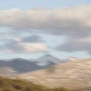
The Truchas Peaks are 25 miles northeast of Santa Fe in the Sangre de Cristo Mountains. Spanish for “trout”, it is north-south trending with four identifiable summits including South Truchas Peak, 13,102’, the second highest independent peak in New Mexico and North Truchas Peak, 13,024’.
The birth of the Sangre de Cristos Mountains, the southernmost subrange of the Rockies, began 80 million years ago when the Farallon Plate slid under the North American Plate at such a shallow subduction, it created a broad belt of mountains running down North America. The low angle moved the focus of crustal melting and mountain building much farther inland than the normal 2-300 miles. Over the past 60 million years, erosion stripped away the high rocks, revealing the ancestral rocks beneath, which have since been eroded by water and glaciers to sculpt the Rockies into dramatic peaks and valleys.
I was fortunate to capture Truchas Peaks in late light, immediately following the first snow.


Read More
2011
“It is not a country of light on things. It is a country of things in light.”
—Georgia O’Keefe
An hour north of Santa Fe, begins a landscape of vast vistas, flat-topped mesas, and tall cliffs with winding rivers bordered by huge old cottonwood trees. Ghost Ranch lies in the broad shallow Chama Basin along the eastern margin of the Colorado Plateau as it transitions toward the Rio Grande Rift further east. Occupying parts of New Mexico, Arizona, Utah and Colorado, the Colorado Plateau has been a relatively stable block in the Earth’s crust for at least 600 million years; consequently the rocks around Ghost Ranch are generally flat-lying and less mildly deformed by broad-scale folding.
The oldest rocks exposed in the Ghost Ranch area belong to a thick package of brick-red to red siltstone and mudstone and white to tan sandstone, deposited by rivers more than 200 million years ago when the Ghost Ranch area was located about 10 degrees north of the equator.
In 1929, painter Georgia O’Keefe first began working part of the year in northern New Mexico, which she made her permanent home in 1949. Between 1929 and 1949, she spent part of nearly every year working in New Mexico. Then in 1934 she first visited Ghost Ranch, north of Abiquiu and decided immediately to live there.
Ghost Ranch’s varicolored cliffs inspired some of her most famous landscapes. “The cliffs over there are almost painted for you – you think – until you try to paint them.” O’Keefe wrote in 1977. “Such a beautiful, untouched, lonely feeling place, such a fine part of what I call the ‘Faraway’. It is a place I have painted before…even now I must do it again.” So how can I resist painting this same landscape with my camera, using the foil of time to render my own interpretation?
To view more images of Ghost Ranch, see Ghost Ranch II and Ghost Ranch III.


Read More
2011
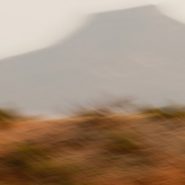
Concentrating once again on the Galisteo Basin, situated between Santa Fe and Albuquerque, I captured the mountain ranges in its south and west quadrants, plus to the north the very southern end of the last of the Sangre de Cristo foothills – such beautiful high desert light emphasizing their relative elevations.
To view more images of Galisteo Basin, see Galisteo Basin I and Galisteo Basin II


2011
So taken by this basin’s spectacular views at Santa Fe’s southern doorstep, I find myself returning again and again.
An upwelling of the Earth’s mantle thirty million years ago caused a pair of parallel fault zones, 40 miles apart, to cut north-south through New Mexico from the San Juan Mountains in south central Colorado to the southwestern tip of Texas; 8-10 million years later, this slice of the Earth’s crust sank as much as 5 miles, creating the Rio Grande Rift, which in turn extended a network of fault patterns that pulled apart the Earth’s crust to the breaking point. From the Rio Grande Rift west to the Sierras, these faults were the genesis of the southwest’s predominate Basin & Range topography: fallen crustal blocks created basins; uplifted blocks became mountain ranges.
Low-angled high-desert light with some cloud cover makes it possible to emphasize the differing characters of these surrounding mountains
To view more images of Galisteo Basin, see Galisteo Basin I and Galisteo Basin III


2011
The Galisteo Basin is classic northern New Mexico high desert landscape. Surrounded by very visible mountain ranges this basin is situated on the east side of the Rio Grande between Santa Fe and Albuquerque. Tilted, and interspersed with wide-open plateaus, the basin offers dramatic views in all directions.
This particular series is the result of one afternoon’s roadtrip south from Galisteo to Stanley, along the east side of the Ortiz, Captain Davis and Lone Mountains, and further south, east of the Sandia Mountains.
Like so much of the American west, what is visible today was formed over the last 30 million years, amounting to less than 1% of the Earth’s 4.6 billion year age
To view more images of Galisteo Basin, see Galisteo Basin II and Galisteo Basin III


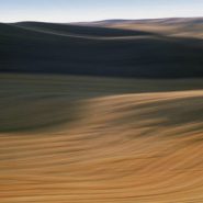
2011
Known for its picturesque, steep, undulating hills, ‘The Palouse’ encompasses the Palouse River watershed rising west out of north-central Idaho’s Blue Mountains to southeastern Washington State, where it turns south emptying into the Snake River.
The unique Palouse region was formed 30 million years ago as the Pacific Plate was pushed beneath the North American Plate, creating a chain of volcanoes that forced molten rock to erupt from cracks in western Oregon’s and Washington’s crust to form the Columbia Plateau basalts. Twenty million years later, the modern Cascade Range lifted up. Two million years ago, glaciers scoured the Pacific NW, generating volcanic silt (“loess”). Prevailing SW winds covered the Palouse’s lava floor with dunes as high as 200’ of wind-blown volcanic silt, resulting in the most fertile land in the northwest.
Lush grasslands provided prime winter grazing for the Nez Perce Indians’ painted ponies, the Appaloosas, until dry land farmers overran this land in the 1880’s. Contour-farming this fertile land for wheat and lentel beans, as high up the slopes as machinery allowed, the varying “painted” shapes have since traced these contours with the seasons’ beautiful patchwork.
Even more visually intriguing than from ground level, this landscape viewed from an isolated 1,000’ high quartzite ‘hill’, Steptoe Butte, offers spectacular aerial views of the Palouse hills.


Read More
2011
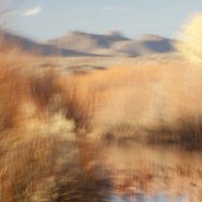
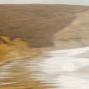
Spanish for ‘Woods of the Apache’, the Bosque del Apache National Wildlife Refuge was established in 1939 to help protect the endangered Sandhill Cranes. Situated on the Rio Grande in south-central New Mexico, 90 miles south of Albuquerque, this tiny high desert wetland serves as a crowded migratory rest stop for thousands of snow geese and 10-15,000 Sandhill Cranes heading down the continent as winter approaches, and again on their return north for breeding season.
Though it’s been eight years since I moved from Maryland’s eastern shore to Santa Fe, I still marvel at the contrast between New Mexico’s high desert wetlands rimmed by 6-7,000’ mountains, to the eastern shore’s low country wetlands surrounded by the Chesapeake Bay. Even more profound, however, is the contrast between the moisture-laden eastern shore light and New Mexico’s high, dry, ever clear atmosphere.
To view more images of Bosque del Apache, see Bosque del Apache II and Bosque del Apache III


2011
One hundred miles south of the Grand Canyon, Sedona sits in front of the Mogollon rim’s 50 million years of exposed sedimentary layering that evidences the formation of the Colorado Plateau 250 million years ago.
To experience first or last light among its red rocks reveals why Sedona has taken on its own spiritual aura. The red Sandstone and tan mudstone coupled with the immediacy of the formations are breathtaking.


Read More
2011
The Edge
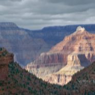
The Grand Canyon at first and last light is one of my very favorite places to be with a camera. For the last six years, 5 to 6 times a year for a week or more at a time, I’ve stood at the Canyon’s rim capturing the light playing on and within its voluminous space.
Concentrating on where the canyon walls end and meet what lies beyond 50, even 80 miles to the east and north, I’ve emphasized its vast desert surroundings. At the Grand Canyon, I am able to breathe, focus, and share in its unconditional peace. It is no accident that my images convey the serenity I seek in my life.


2007
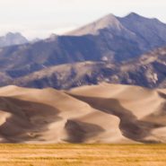
As the sun drops behind the San Juan Mountains, 75 miles across the San Luis Valley, the last direct light on North America‘s tallest and highest dunes causes the volcanic sand to glow.
This Colorado dune field evolved out of the last major volcanic activity in the San Juan Mountains, 30 million years ago. The Rio Grande carried volcanic ash eastward, while prevailing southwesterly winds plus the snowmelt from the Sangre de Cristo Mountains have maintained its unique balance.
My own visual interpretation of the events that have created this particular evolution in the passage of time is not unlike The Jicarilla Apaches’ “it goes up and down” and the Utes’ “the land that moves back and forth.”


2007
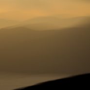
Pacific NW Coast III
This is my third series captured during my 2010 roadtrip along the northern California and Oregon coasts. Though rarely blessed with optimal light, I was able to take the time for moments of sun to break through. From the cliffs along the Lost Coast in northern California, to the many rivers flowing into the Pacific, to the wonderfully wide and empty Oregon beaches, to tidal Netarts Bay just north of Cape Lookout contained by a five-mile stretch of beach, the Pacific NW coast is rugged and varied.
The south-flowing Pacific current along the NW coast and the weather, both constantly in motion, offer the perfect foil for overlaying my images with a sense of the passage of time.


2007
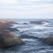
Pacific NW Coast II
Sea stacks — offshore monoliths, also known as haystack rocks — are either the result of portions of headlands splintering off, or from under sea lava flows, or from lava flowing into the sea. Cooling lava became hardened basalt over time; this heavy basalt remained buried under marine sediments for millions of years. As the climate shifted and the sea level receded, the rocks were revealed be either attached to the shoreline or off shore. Their dark shadows cast on the water further accentuate their interesting shapes.
Primarily images of haystacks, I captured this series along the Oregon coast under varied lighting conditions that invariably depended on the degree of cloud cover.


2007
Pacific NW coast
In 2010 I made an extensive roadtrip beginning south of the California-Oregon border traveling north along the rugged and beautiful Pacific NW coast to Astoria, overlooking the Columbia River and the Washington border.
Along this coast are intermittent capes protruding into the Pacific that offer expansive cliff views, interspersed with stretches of very wide beaches, sand dunes, and hundreds of haystacks just offshore, plus the many rivers draining the Coastal mountains, this nearly 500 mile stretch of the northwest coast is simply breathtaking. This series plus the next two comprise my October “capture” of this stretch of the Pacific Northwest coast.


2007
Tomales Bay
Tomales Bay, a 15 mile long by mile wide inlet of the Pacific Ocean, separates Point Reyes Peninsula from the Marin County mainland, 30 miles north of San Francisco. The bay forms the eastern boundary of Point Reyes National Seashore and lies along a submerged portion of the San Andreas Fault.
On its northern end, Tomales Bay opens out onto Bodega Bay, which shelters it from the direct current of the Pacific.
Nestled between the Marin hills to the east and the Point Reyes Peninsula’s rolling hills to the west, this tranquil bay offers lovely views of the edges of these two land masses.


Read More
2007
Drakes Bay
Thirty miles north of San Francisco, southwest facing Drakes Bay is situated on the lee side of the southern coastal current of Point Reyes Peninsula. Long considered Drake’s most likely landing spot on North America’s west cost during his 1579 world circumnavigation,
Drakes Bay is backed by dramatic white sandstone cliffs that were created 10-13 million years ago. Erosion has revealed the striations of this story in the cliff faces.
The constant pounding of the Pacific combined with the magnificent 8-mile curved Bay’s tempestuous weather emphasizes the incessant passage of time.


2007
Zabriskie Point lies along the eastern border of California offering sweeping views West across Death Valley’s floor to the Sierra Nevada front-range. The Sierras run 400 miles north-south and 70 miles west-east. Included within this bountiful mountain range is Lake Tahoe, the largest alpine lake in North America, Mount Whitney at 14,505’ the highest point in the contiguous U.S., and Yosemite Valley sculpted by glaciers out of 100 million-year-old granite.
Four million years ago, the Sierra range began to uplift. Subsequent glacial erosion exposed the granite, forming the light-colored mountains we see today. Approaching the Sierra Nevada Range from across Death Valley provides an even more dramatic perspective of the ethereal vertical-rise.


Read More
2010
The Light Within
My second Grand Canyon series concentrates on the world-within-a-world. By excluding direct sunlight from the frame, I explore intimate moments within the immeasurable space. Each crease and fold flows deeper, absorbing the high desert light that reflects every facet of the surrounding canyon walls.
A half mile below the rim, a world of buttes, towers and mesas emerge in every shade of the sedimentary palette — gray, tan, pink, red, orange, yellow and brown. The enormous scale of the canyon blends and diffuses their color and intensity according to distance and depth. In dramatic contrast, the 1.7 billion year old dark, veined granite gorge plummets another half mile as the Colorado River rushes through its belly. As the sun arcs across the canyon walls, Condors and Ravens soar the thermals.


2007
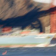
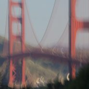
Containers In, Containers Out
San Francisco’s Golden Gate shipway has a depth of 300’ plus 220’ of bridge clearance allowing the famous Bay entrance access to all forms of commercial shipping. Most prevalent are the container ships plying the Asian-North American markets. Piled high, these ships are spectacular behemoths in size, mass and color, and their graceful, quiet passage provides a visual foil that equals the narrows’ tides and weather and the magnificent Bridge above.


Read More
2007
The Bridge
In 1916, a bridge connecting San Francisco to Marin was first seriously considered. Seventeen years later after extensive design and engineering editions, political maneuvering and WWI interruptions, construction finally began. In 1937 the majestic Golden Gate Bridge was completed.
Truly a masterpiece in every sense, the Golden Gate Bridge became the grandest of functional art. Painted orange vermillion to compliment its natural surroundings while still appearing as visible to ships as possible, its aesthetic design is equal to its superior engineering. Who isn’t enamored with its iconic grace?


Read More
2007
San Francisco Coastline
Stretching south from the Golden Gate Bridge, the houses high along Presidio Cliffs gradually descend to Baker Beach and Pt. Lobos beyond, creating spectacular views along this idyllic portion of the San Francisco coastline. The panorama includes the Bridge, Marin Headlands, the ship traffic, the ocean, and on very clear days the Farallon Islands, 27 miles west.
Churning that coastline is the continuous suction of the sea followed by its mad rushes at the mile-wide gate. And the weather is almost always either pushing or pulling, with or against tides. My challenge is to portray that force.


2007
Marin Headlands
Looking north across the golden gate, the Marin Headlands provide a unique perspective; the contrast of the ocean against the colors and textures on the headland’s face. The headland receives the sunlight directly, and reflectively from the water. The channel provides unobstructed first and last light, while the ever-changing weather plays its part.


2010
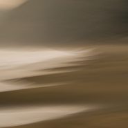
Ocean Point, Maine
For twenty years I have been drawn to the ebb and flow of the tides, the velocity of the wind and the sun’s shift in dynamic relationship with the Maine Coast east of Boothbay Harbor. To visually match the ocean’s energy as it engages with the shore, I use camera strokes to blend color and stretch light, evoking the passion in the elements’ evolving effect on the shoreline.


2007
Driving West to the Grand Canyon from Santa Fe, five miles east of the Continental Divide, at 7,200’ elevation, the sun’s low angle dramatically rakes the south face of the Colorado Plateau’s sandstone cliffs.


2007
The Space Between
For the last thirty years, I have consciously evolved my camera strokes to best infuse the passage of time that turned the landscape into single ‘unstill life’ images. The Grand Canyon represents 1.7 billion years of limitless space, a giant vessel through which you can see the countless layers of time.
Looking down more than a mile from the rim to the Colorado River, the stunning array of sedimentary layers, colors, tones and shades represent advancing and retreating ocean coastline deposits of sandstone and shale. This iconic place, where the land so clearly recounts its own story, has become a pilgrimage for me as spiritual as any I have found.


Read More

2007
Dancing With Pelicans
I began photographing the Golden Gate in earnest in 2007, as a daily diversion whenever visiting San Francisco to see my 93 year old, failing mother. From the San Francisco side of the bridge, the Marin Headlands, the Presidio Cliffs and Baker Beach, the mile wide strait, the ocean beyond, the Bridge, and the ships all proved to be ready subjects.
Surrounded by this incredibly diverse and active landscape, pelicans are a reassuring constant, with their grinning profiles as they migrate north in the winter to breed. Brown Pelicans, even with their six-foot wingspans, are the smallest of the eight pelican species and the only ones that dive for fish. Surfacing with their enormous bills full, the water drains leaving the fish to be swallowed. Working the coastline at varying heights in squadron-like formation, upon spotting a school of fish, they skim the water in single file pursuit of their next meal.
Gliding high above the Bay, pelicans are a visual counterpoint to man’s incessant activity at the Golden Gate. Although prehistoric in nature, their peaceful flight is more efficient than man with all his trappings.


2007
Santa Fe sits on the windward side of the Sangre de Cristo (Blood of Christ) mountain range. This southernmost subrange of the Rocky Mountains extends from Southern Colorado to Glorieta Pass southeast of Santa Fe.
Immediately northeast of Santa Fe, Santa Fe Mountain’s (10,350’) west face is blessed with an enormous aspen stand. Lit by the evening’s last light, they glow atop the mountain for all of Santa Fe to see.
Amongst the Aspens’ beautiful taupe trunks are the occasional aberrant blood-orange boles. Standing out like sentinels, their contrast is truly magical.


2006
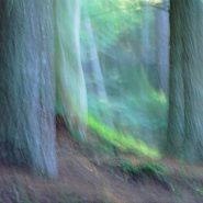
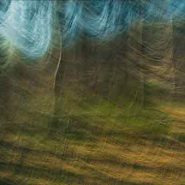
In the Woods
Fifteen years after Trees I, I returned to my earliest motif. Trees were no longer a subject to be mastered, I saw their nuances and spirit in a way I had not earlier in my career. In deconstructing these images, I walked a fine line between representation and abstraction, yet when I released control and allowed the trees to speak, their story informed my lens.


2002
Passages of Time
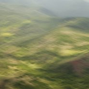
In this series, I focused on two regions, north-central Oregon and southeastern Washington. Both volcanic in origin, they provided extremely unique landscapes. By narrowing the content in my images, I found I could portray a visual intimacy in the sensuous curves of land and the richness of the summer colors.
My relationship with the land deepened as I stretched light and color, blended emulsions and increasingly related my camera strokes to the landscape’s flow.


2000
The expanse of the sea has always fascinated me. At 22, two of us crossed the Atlantic in a 33-foot sailboat. Thirty years later, living and sailing on a tidal river flowing into the Chesapeake Bay reawakened that ultimate sense of freedom for me. Weather’s myriad of moods on the water — from the calm of the river at my home on the Eastern Shore to the pounding of the Pacific Ocean — provided me another extreme visual palette.


1999
Western Space + Time
Having awakened my appetite for large-scale landscape, I explored other western vistas in Wyoming, Utah, California and northern Arizona, in addition to return visits to the high country of Montana. Experimenting with the panoramic format, I found it easier to capture the breadth of the land while more closely matching its flow.
During the creation of this series, I first realized that my obsession with condensing time via motion within a single frame was intimately linked to a lifetime of restlessness.


1997
Needing an escape from urban living, I spent weeks in the solitude of Montana’s incredible high-country where I first experienced the grandeur of western landscape. It’s grand distances, unavailable in the Washington, DC parks, opened up a host of new possibilities in light, color and resolution that took me to a place I hadn’t experienced since the transatlantic ocean sailing days of my early twenties.


1992
Twenty years ago, I began my journey as an interpretive landscape photographer in my own backyard — the dramatic parks of Washington, DC. There was an unlimited variety on which to concentrate, and their close proximity allowed for easy repeat visits to my new subjects.
I experimented with color, texture and gesture in my first commitment to pure landscape. By overlaying images with an expanse of time, I was seeking my own style to portray the way I saw the world through the lens of my moving camera.


